Showing posts with label Summer 2011. Show all posts

Monday, May 7, 2012

Finishing up summer 2011

Wednesday August 31 - Sept 4, 2011
Leave Bush Islets, Johnstone Strait
Arrive Home, Ladysmith Harbour
via: Owen Bay Sonora Island, Open Bay Quadra Island, Tribune Bay Hornby Island, Nanaimo Harbour Vancouver Island.
So, I have been a little lazy with the blog these past few months, and now that boating season is just about here, I thought I would finish up last years posts and the move on.
Coming south through Johnstone Strait, you just never know what you will see. This is the first time we have seen Orca so close, although apparently they are quite common. This group of three was part of a larger pod of maybe 15-20, and they came within about 30 feet from our boat. Very exciting to say the least, I love seeing these beautiful animals in the wild.
We did not run into any fish nets this time, and we really kept a close watch for them. The rest of our trip home was uneventful (possibly why I haven't posted anything! haha), but absolutely beautiful weather all the way. We tried crabbing in Nanaimo Harbour (Steve said we would catch some), but came up empty.
We are currently getting the boat ready for this summer's trip..... Haida Gwaii for a month. We are leaving at the end of June and will be out on the water until early September.
I will try my darndest to keep you posted, I do have some posts ready, so keep a watch on our blog if you are interested in boating.
Cheers!!

Tuesday, March 27, 2012

Back to Bush Islets, Johnstone Strait

Tuesday August 30, 2011
lv Port McNeill
arrv Bush Islets, Johnstone Strait 50 31.11N, 126 27.73W
There are not too many places to hole up while you are transiting Johnstone Strait and since we had a nice anchor in this location going west, we decided to try it again going east. Last time we had the anchorage to ourselves, this time two kayakers have set up camp on one of the islets. Kayaking in Johnstone Strait?.... either you are very brave or very foolhardy. This is not an area I would be inclined to kayak, period!


We enjoyed the company of a pod of porpoise for quite awhile, and I got a few pictures (of water with little splashes) and two videos. The one above is about 1.5 minutes long and is quite fun to watch them dart back and forth in front of our boat. They stayed with our boat for probably close to 30 minutes. So much fun!

Tuesday, February 7, 2012

Oh Happy Day!

Monday August 29, 2011
Leave Miles Inlet
Arrive Port McNeill 50 35.99N, 127 05.27W


MY FIRST SALMON!! SWEET!!
You really have no idea how happy I was in this picture. Un-believeable! And not only one, but here is .......
FISH NUMBER TWO!!
Yes, now I know how to catch a salmon. My ego has gone up numerous notches. Fresh caught salmon on the BBQ for dinner, yumm.
Looking west in Johnstone Strait, heading into Port McNeill, at the setting sun. 

Taking pictures of whales.


This is what my "whale" pictures usually look like, or like......

this (at least there is some action!). But on this particular day......

I managed to get this! And.......

this and.......

 this one and ......

this one!
Mind you, I took close to 100 pictures over about 30 minutes and most of them were of just plain water. It was the most amazing whale encounter we have had. We sat quietly and this whale was up and down feeding on herring all around us. Most of the time we could predict where he would come up because we could see his "bubble net". In one picture, you can see him with his mouth open, catching the herring as he broke the surface.
This is one of the reasons I love getting out on the boat.... these types of experiences you cannot get anywhere else.

Miles Inlet

Sunday August 28, 2011
leave Millbrook Cove
arrive Miles Inlet 50 04.04N 127 47.44W
The rocks here are exposed to the waves in Queen Charlotte Sound.

This is at the entrance to Miles Inlet, a place we have always passed by. But this time we were a little ahead of schedule and we thought it looked like an interesting place to explore. Miles Inlet is almost shaped like a capital letter I, with a few extra nooks and crannies added for good measure. There is three reversing waterfalls inside the inlet and not a lot of places to anchor. But, with only one other sailboat in the inlet, we had lots of room.
We got settled in and then put the crab trap down to see what was available on the bottom. Thirty minutes later, we hauled in 2 very nice rock crab. All in all, we caught three keepers, and let the other 20 or so go.
After dinner, we kayaked over to the reversing falls for a closer look. On the way, we stopped to chat with the other boat, a couple from Seattle. They shared their method of catching salmon off a sailboat, said they pretty much have been living off the sea all summer long. Sounded promising, but anything does since I have not managed to catch even a single salmon, although I am not too bad catching rock cod. We will give it a try tomorrow.

Reversing waterfalls, always worth checking out.

Saturday August 27, 2011
leave Joe's Bay
arrive Millbrook Cove, Smith Inlet 51 19.67N, 127 44.16W
Jerry winding up his anchor trip line in a sea of foam in Joe's Bay.
Yesterday, in Joe's Bay, we went back to the reversing falls after dinner in the kayaks. It wasn't that big of a tidal change, but it was cool to see. Then early this morning, we could hear the roar of the falls picking up and by the time we were pulling the anchor, the little bay was full of foam from the action of the waterfalls.
The bay was super calm and you can see in the picture above our trail through the water as we left.
Onward!

Sunday, January 8, 2012

I love this picture........

Lion's mane jelly fish in Pruth Bay.

Joe's Bay

Friday August 26, 2011
leave Illahie Inlet
arrive Joe's Bay, Fish Egg Inlet 51 38.94N 127 45.58W

Splendid Mane tucked up against the shore in Joe's Bay.
We don't know who Joe is, but his little bay sure was nice. After we got anchored and stern tied, we got in the dingy to explore. In our guide book, it says there is a reversing falls behind the islet we can see in front of us. So we motor over to have a look, and it just so happens that tides levels are about even, so we continue on for some more exploring. After about 10 minutes of slowly putting along, the inlet began to narrow and lots of little islands dotted the landscape. We stopped on one, and built a small Inukshuk.... should be fun to see if it is still there when we go back, maybe this summer.
One of the small islets in Fish Egg Inlet.
Back on Splendid Mane, we enjoyed our afternoon happy hour. As we were quietly sitting in the cockpit, we began to hear some noises coming from the shore..... grunting and snorting and huffing. We never saw it, but it definitely sounded like a bear, upset that someone else was in his bay. 
What is this?

Illahie Inlet off Fish Egg Inlet

Thursday August 25, 2011
leave Pruth Bay
arrive Illahie Inlet off Fish Egg Inlet 51 39.92N 128 49.08W
This is another stop that very few boats make. It is a series of little dead end inlets virtually untouched by anyone. We explored around a few before we settled on a nice location for the night. The weather has been co-operating lately, and we enjoy a beautiful sunset with our dinner.

Tuesday, December 27, 2011

Back to Pruth Bay

Tuesday August 23 and 24, 2011
leave Bremner Bay
arrive Pruth Bay 51 39.24N 128 07.44W
This cheeky raven was looking for a handout.
So here we are back in Pruth Bay. If truth be told, we came back looking to catch s**t load of dungeness. We put the anchor down on the opposite side of the bay this time, then put out the crab trap (with a salmon head) and waited an hour or so. Pulled up the trap, nothing. So put it back and waited again.... trap up, nothing. Maybe all the crabs really are on the other side. The next morning, we pulled up the anchor and went to the other side, exactly where all the crabs were last time. Put the trap down and got in the dingy to head over to the beach.
West Beach, Calvert Island
This is our third time on this beach, and this time we turned left instead of right and walked a couple miles all the way to second beach. It is a beautiful coast line, with unbelievable beaches, definitely worth the walk. 
This was either third or forth beach.
These were on the side of the trail, but not sure what type they are. I can't help it, I love taking pictures of mushrooms too!
Now, back at the boat, we pulled up the crab trap again, and yes, you guess it, nothing!! Oh well, we still love coming to this spot and will come here again, crab or no crab!

Kildidt Narrows and Inlet

Monday August 22, 2011
leave Spitfire
arrive Kildidt Lagoon, Gnat Group then move to Bremner Bay 51 50.80N 128 06.78W
Looking glass water just at the eastern end of Spitfire Channel, going into Kildidt Sound.

Halfway inside Kildidt Inlet.
After pulling up anchor in Spitfire Cove, we carefully navigated our way through Spitfire Channel, the beginning of which is only 20 feet wide and a least depth of 6 feet at a zero tide. To add to the difficulties, there is a tree overhanging the entry by about 10 feet. So, we chose high tide to go through, but even with the extra room, it was probably the tightest narrows we have been through. Coming out the other side into Kildidt Sound, the water was so smooth, we felt like intruders into another world. 
Without hesitation, we decided to carry on through Kildidt Narrows and explore Kildidt Inlet. We did not see any other boats nor any evidence of people, as in logging, float homes, roads or garbage. If you want a feeling of isolation, this is the place to be. It was just us and the seals. 
Brown water from the cedar trees.
We anchored near the Gnat group of islands, got in the dingy and headed back to the narrows for a look at low tide. The water in the inlet is stained brown from all the run off from the cedar trees, but as we got closer to the narrows, it cleared up and we could see the bottom.....
If we wanted sea cucumber for dinner, we would have had no problem getting enough to feed a crowd.
As you have read before, I love taking pictures of the underwater life, and here it was beautiful of course. We also spotted a colony of sea pens growing on a sandy spot in about 15 feet of water, but I had trouble getting a good picture because the current was pushing us around too much.
Back at the boat, we decided to pull anchor and head back out through the narrows and find a more sheltered spot for the night which is why we ended up in Bremner Bay. The boat we were anchored with in Spitfire was already there, so I guess we both had the same idea. We slept nicely.
Monday, December 26, 2011

Spitfire Anchorage... some history from WWII

Sunday August 21, 2011
leave Superstition Cove
arrive Spitfire West Cove, Hurricane Island 51 51.51N, 128 12.27 W


After the rocking and rolling from the previous night, we decided to snuggle into a nice calm cove. We picked Spitfire Cove on Hurricane Island because it said it was snug in the guide book (Cruising the Secret Coast). Another boat had the same idea, but we managed to fit in okay. True to it's word, the book was right and we enjoyed a very calm night.
The islands in this area are named after air force planes from WWII. There is a ruin of a radar station from the 1940's on Spider Island. We didn't stop since we were not having the best of weather, but it definitely deserves a look on another trip, maybe we will be back there this coming up summer.

Back at it after the Christmas break....

Saturday August 20, 2011
exit Kinsman Cove
arrive Superstition Cove, Hunter Island 51 53.52N, 128 14.46W

This area is starfish heaven, in every colour you can imagine.
I know it has been awhile since my last post, but seriously, I have been busy doing the Christmas thang. But now that we are more or less back to normal around here, I feel like I really should finish off our trip this summer, at least before we take off again on another journey!
Nice thing about blogging about our trip now, is that I get to almost relive all the fun times we had.... such good memories.
So, our next stop was Superstition Cove as we made our way south along Hunter Island. The cove is somewhat exposed to the west but we thought we would give it a try. We had it to ourselves and it seemed to be a nice enough anchorage, but as luck would have it, the wind picked up a bit and we ended up having a rocky night. A little bit of rocking is okay, but this was too much and neither of us got a good nights sleep. We didn't do any exploring here as the weather was not that great. In nicer weather, this would be a place to stay a couple nights.

Sunday, November 20, 2011

Reversing Waterfalls on Hunter Island

Friday August 19, 2011
exit Lane Rock Cove
arrive Kinsman Cove, Hunter Island 51 55.68N, 128 09.50W
One of the reversing waterfalls at low tide.
If you are out boating by yourself, your time is your time and you can do whatever you want. Sometimes we loose track of time and sometimes we pay no attention to time. Today is one of those days. We enjoyed a beautiful morning, sipping coffee and reading, waiting for the tide to change so we could see the reversing waterfalls. Just before lunch, it looked like they might be maxed out for the morning, so we got in the dingy to get a closer look. In areas like this, where there is lots of water flowing back and forth, the sea life is incredible. Everything is competing for space on the rocks or seafloor. It is really beautiful.
Our next anchorage, Kinsman Cove, is a cozy two boat cove, but promises some interesting adventures for tomorrow.

Leaving our new favorite place.

Thursday August 18, 2011
exit Goose Island
arrive Lane Rock Cove, Hunter Island 51 54.73N, 128 11.46W
Sunset in Lane Rock Cove.
I am back to posting after taking time off to visit the grand children in Alberta and other assorted duties. But I need to get our summer trip finished on this blog before we start a new trip! Besides, thinking about all the fun we had this past summer makes me feel warmer as I sit at my computer and look across the harbour at the snow covered mountains.
Two days in the Goose Islands and now we are heading back over to the mainland. The wind picked up as we pulled up the anchor and we were able to get a nice motor sail in. Just as we were approaching the mainland, we could see a storm coming in from the west and hoped the other sailboat we were anchored with got away too. It would not be a comfortable place to spend the night during a blow.
We anchored in a little nook called Lane Rock Cove, just in front of an islet that blocks the entrance to a lagoon, creating twin waterfalls that reverse with the tide. It is a magical place.

Wednesday, October 12, 2011

Goose Island

Tuesday August 16 & Wednesday August 17, 2011
exit Louise Channel anchorage
arrive Goose Island 52 55.84N, 128 26.00W our farthest point north and west.
The low profile of the Goose Group of islands at low tide.

Last night we talked, planned, schemed and talked more about whether or not we should head out to Goose Island. In the end, as you can see, we decided to go. The reason we were hesitant was because it is a small group of very low (therefore no protection) islands about 6 miles from the mainland coast. Not really a great distance, but far enough that you don't want to get caught out there in the weather turns nasty which it easily can without much warning. But the forecast look favorable and we were in the mood!
Goose Island at sunset. The other boat arrived on our second night there.

Our rational was that we could always bail if the nasties came up. But we had a beautiful crossing and got anchored snuggly and right away decided that we would be staying two nights because is was sooo beautiful, not to mention isolated, what more could you ask for? Even after spending two days here, we did not get to all the little nooks and crannies we had hoped. 
Just after we got anchored, we got the dingy in the water and motored around Gull Island, a small island about half a mile in length. The the next morning, we dingyed over to Gosling Island, beached it and hiked over the island to a bay on the south side to explore.  A very nice hike though the woods, like walking though an old growth rain forest. The beaches here have sand that is just like silk, so soft and deep! Later in the day, after lunch we motored in Tail over to Goose Island to explore the beach for treasures.... and yes, I did find a treasure or two. In the end, I managed to find two glass fishing floats! Just what I was looking for. Jerry ask me if could find him a 100 oz gold bar, but so far I have not been able to. I will keep looking though.

Louise Channel Anchorage and kayaking.

Sunday August 15 & Monday August 16, 2011
exit Lockhart Bay
arrive Louise Channel Anchorage 52 07.23N, 128 20.92 W

Our kayaks parked on a small islet at the south end of Louise Channel at low tide.

This well protected anchorage, between Potts Island and Stryker Island, is pretty much as far as you can safely go through Louise Channel in a sailboat, but with a power boat you could continue on another half a mile or so to another snug anchorage. Again, we have picked a beautiful, quiet place to spend some time. In this case, we decided to spend two nights here. The area is prime for kayaking, and we were chomping at the bit to get back into the kayaks. This is one the things I just love doing... heading out in the kayaks to explore little islands and shorelines, especially now that I have my waterproof camera and I can get under water pictures. With the kayaks, we can get into all the little nooks and crannies that you can't get to in a boat and sometimes even the dingy doesn't work. The other thing about using the kayaks instead of the dingy, is that they are so quiet and we can sneak up on creatures great and small.
One of these weird and wonderful trees that grow on rocks all along the coast.

We headed out in the kayaks just before low tide so we get the advantage of the current going with us, then landed on a small islet, stretched our legs and had a snack, and then headed back up the channel with the tide rushing in...... sweeeet! It is just like having a little engine on the back of the kayak.


Tuesday, October 11, 2011

Saying Goodbye!

Friday August 12, 2011
exit Shearwater
arrive Lockhart Bay Horsfall Island 52 12.19N, 128 15.47W
This is where we are parting ways with Invictus. It has been so much fun boating along side with them and I am sure we will do it again next summer. But they have to start their journey towards home, and we still have lots of time to play!
I love the colours in this picture... looking towards the mainland coast mountains, just outside Bella Bella.
Our day was pretty uneventful, mostly grey and no wind. Our first stop was at Bella Bella to fill up with fuel and water since they don't have potable water in Shearwater (not sure why not, but that is what they told us).
Our first pick for anchorage, just west of Mallory Islands, was too crowded with fishing charter boats, so we turned around (very tight anchorage) and went a little further on, anchoring in very quiet Lockhart Bay.
Saturday August 13, 2011
Decided to stay another day in this beautiful bay, something we call a home day, where you just stay put. We waited for the rain to stop, and then used the dingy to explore the shore. Not much to report except a very large mass of fishing net and floats caught up on the rocks close to shore. It looked awful, but lots of creatures were making in into a home so we left it alone. Spent most of the day reading and just hanging.

And now for something completely different: tying up to a dock!

Thursday August 11, 2011
exit McNaughton anchorage
arrive Shearwater 52 08.87N 128 05.27W
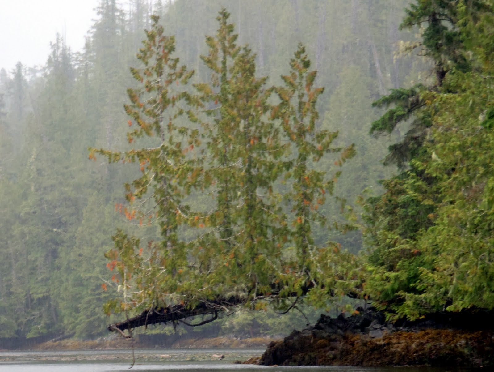
Jerry and I got up a little earlier than usual which would be about 7. We had our breakfast, then jumped in the kayaks for a look around at low tide. The area where P & R had toured the day before was not accessible because of the low tide, so we decided to head the other direction. We were just going to go through 'that channel', then oh, well, lets just head around the island. All in all, it took us about two hours to paddle around the island we were anchored next to. Saw some dolphins, a couple whales and lots of interesting life along the shores at low tide. Yes, we did end up at the awesome tree, just made it through the drying area on a rising tide.
Where's mommy?

I spent a couple hours on Invictus trying my hand at fishing again with no luck. Back on Splendid Mane for a late lunch and we are giving P & R a little break from Pahokee (their little white dog), and then he gets to ride on the smooth sailing boat! Did you ever notice how power boaters most likely have a little white dog? 
Next stop, Shearwater. We arrive ahead of Invictus (they were still trying to catch a fish) and secure a place at the dock for both boats. We got some fuel, but then decided not to completely fill the tank because they didn't have potable water at the dock and we would have to stop at Bella Bella to get it anyway. Mom treats us all to dinner at the Shearwater Cafe, a nice change from boat food. Thanks Mom!

Monday, October 3, 2011

Serpent Group, then on to McNaughton Island

Invictus and Splendid Mane anchored for lunch in the Serpent Group.

Wednesday August 10, 2011
exit Underhill Island anchorage
arrive McNaughton Island NW Anchorage, 51 56.30N 128 13.81 W
"Tropical" beach in Serpent Group, just SW of Hunter Island.

We stopped for lunch in a beautiful spot, seems like out in the middle of nowhere, with a white sand beach but cold water. We took the dingy's to shore to do some exploring and also harvested a feast of mussels for dinner.
Jerry, relaxing in the sun.
A nice little cove with good wind protection, so it was very quite overnight. Jerry and I relaxed on board while Peter and Roma went out in Tuglet for a tour around the area. They came back all excited that they had seen the most coolest tree ever. We decided to wait for morning and head out in the kayaks for a tour.