Tuesday, December 27, 2011

Kildidt Narrows and Inlet

Monday August 22, 2011
leave Spitfire
arrive Kildidt Lagoon, Gnat Group then move to Bremner Bay 51 50.80N 128 06.78W
Looking glass water just at the eastern end of Spitfire Channel, going into Kildidt Sound.

Halfway inside Kildidt Inlet.
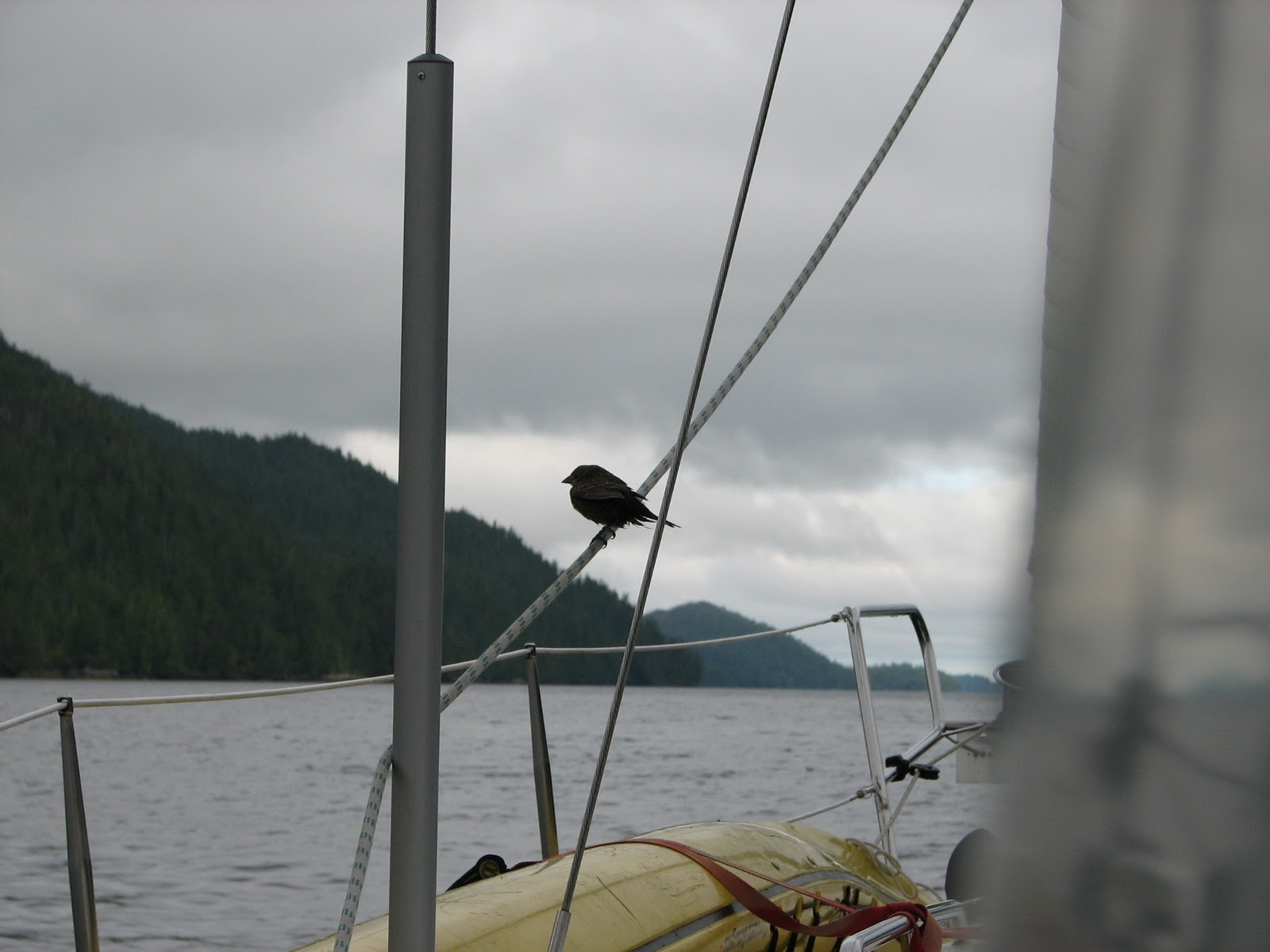
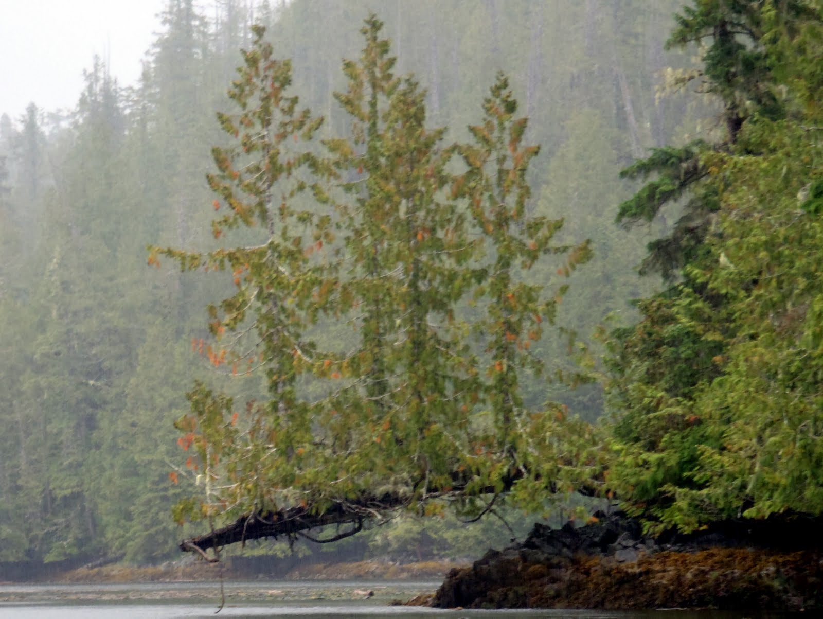
After pulling up anchor in Spitfire Cove, we carefully navigated our way through Spitfire Channel, the beginning of which is only 20 feet wide and a least depth of 6 feet at a zero tide. To add to the difficulties, there is a tree overhanging the entry by about 10 feet. So, we chose high tide to go through, but even with the extra room, it was probably the tightest narrows we have been through. Coming out the other side into Kildidt Sound, the water was so smooth, we felt like intruders into another world. 
Without hesitation, we decided to carry on through Kildidt Narrows and explore Kildidt Inlet. We did not see any other boats nor any evidence of people, as in logging, float homes, roads or garbage. If you want a feeling of isolation, this is the place to be. It was just us and the seals. 
Brown water from the cedar trees.
We anchored near the Gnat group of islands, got in the dingy and headed back to the narrows for a look at low tide. The water in the inlet is stained brown from all the run off from the cedar trees, but as we got closer to the narrows, it cleared up and we could see the bottom.....
If we wanted sea cucumber for dinner, we would have had no problem getting enough to feed a crowd.
As you have read before, I love taking pictures of the underwater life, and here it was beautiful of course. We also spotted a colony of sea pens growing on a sandy spot in about 15 feet of water, but I had trouble getting a good picture because the current was pushing us around too much.
Back at the boat, we decided to pull anchor and head back out through the narrows and find a more sheltered spot for the night which is why we ended up in Bremner Bay. The boat we were anchored with in Spitfire was already there, so I guess we both had the same idea. We slept nicely.

Monday, December 26, 2011

Spitfire Anchorage... some history from WWII

Sunday August 21, 2011
leave Superstition Cove
arrive Spitfire West Cove, Hurricane Island 51 51.51N, 128 12.27 W


After the rocking and rolling from the previous night, we decided to snuggle into a nice calm cove. We picked Spitfire Cove on Hurricane Island because it said it was snug in the guide book (Cruising the Secret Coast). Another boat had the same idea, but we managed to fit in okay. True to it's word, the book was right and we enjoyed a very calm night.
The islands in this area are named after air force planes from WWII. There is a ruin of a radar station from the 1940's on Spider Island. We didn't stop since we were not having the best of weather, but it definitely deserves a look on another trip, maybe we will be back there this coming up summer.

Back at it after the Christmas break....

Saturday August 20, 2011
exit Kinsman Cove
arrive Superstition Cove, Hunter Island 51 53.52N, 128 14.46W

This area is starfish heaven, in every colour you can imagine.
I know it has been awhile since my last post, but seriously, I have been busy doing the Christmas thang. But now that we are more or less back to normal around here, I feel like I really should finish off our trip this summer, at least before we take off again on another journey!
Nice thing about blogging about our trip now, is that I get to almost relive all the fun times we had.... such good memories.
So, our next stop was Superstition Cove as we made our way south along Hunter Island. The cove is somewhat exposed to the west but we thought we would give it a try. We had it to ourselves and it seemed to be a nice enough anchorage, but as luck would have it, the wind picked up a bit and we ended up having a rocky night. A little bit of rocking is okay, but this was too much and neither of us got a good nights sleep. We didn't do any exploring here as the weather was not that great. In nicer weather, this would be a place to stay a couple nights.

Sunday, November 20, 2011

Reversing Waterfalls on Hunter Island

Friday August 19, 2011
exit Lane Rock Cove
arrive Kinsman Cove, Hunter Island 51 55.68N, 128 09.50W
One of the reversing waterfalls at low tide.
If you are out boating by yourself, your time is your time and you can do whatever you want. Sometimes we loose track of time and sometimes we pay no attention to time. Today is one of those days. We enjoyed a beautiful morning, sipping coffee and reading, waiting for the tide to change so we could see the reversing waterfalls. Just before lunch, it looked like they might be maxed out for the morning, so we got in the dingy to get a closer look. In areas like this, where there is lots of water flowing back and forth, the sea life is incredible. Everything is competing for space on the rocks or seafloor. It is really beautiful.
Our next anchorage, Kinsman Cove, is a cozy two boat cove, but promises some interesting adventures for tomorrow.

Leaving our new favorite place.

Thursday August 18, 2011
exit Goose Island
arrive Lane Rock Cove, Hunter Island 51 54.73N, 128 11.46W
Sunset in Lane Rock Cove.
I am back to posting after taking time off to visit the grand children in Alberta and other assorted duties. But I need to get our summer trip finished on this blog before we start a new trip! Besides, thinking about all the fun we had this past summer makes me feel warmer as I sit at my computer and look across the harbour at the snow covered mountains.
Two days in the Goose Islands and now we are heading back over to the mainland. The wind picked up as we pulled up the anchor and we were able to get a nice motor sail in. Just as we were approaching the mainland, we could see a storm coming in from the west and hoped the other sailboat we were anchored with got away too. It would not be a comfortable place to spend the night during a blow.
We anchored in a little nook called Lane Rock Cove, just in front of an islet that blocks the entrance to a lagoon, creating twin waterfalls that reverse with the tide. It is a magical place.

Wednesday, October 12, 2011

Goose Island

Tuesday August 16 & Wednesday August 17, 2011
exit Louise Channel anchorage
arrive Goose Island 52 55.84N, 128 26.00W our farthest point north and west.
The low profile of the Goose Group of islands at low tide.

Last night we talked, planned, schemed and talked more about whether or not we should head out to Goose Island. In the end, as you can see, we decided to go. The reason we were hesitant was because it is a small group of very low (therefore no protection) islands about 6 miles from the mainland coast. Not really a great distance, but far enough that you don't want to get caught out there in the weather turns nasty which it easily can without much warning. But the forecast look favorable and we were in the mood!
Goose Island at sunset. The other boat arrived on our second night there.

Our rational was that we could always bail if the nasties came up. But we had a beautiful crossing and got anchored snuggly and right away decided that we would be staying two nights because is was sooo beautiful, not to mention isolated, what more could you ask for? Even after spending two days here, we did not get to all the little nooks and crannies we had hoped. 
Just after we got anchored, we got the dingy in the water and motored around Gull Island, a small island about half a mile in length. The the next morning, we dingyed over to Gosling Island, beached it and hiked over the island to a bay on the south side to explore.  A very nice hike though the woods, like walking though an old growth rain forest. The beaches here have sand that is just like silk, so soft and deep! Later in the day, after lunch we motored in Tail over to Goose Island to explore the beach for treasures.... and yes, I did find a treasure or two. In the end, I managed to find two glass fishing floats! Just what I was looking for. Jerry ask me if could find him a 100 oz gold bar, but so far I have not been able to. I will keep looking though.

Louise Channel Anchorage and kayaking.

Sunday August 15 & Monday August 16, 2011
exit Lockhart Bay
arrive Louise Channel Anchorage 52 07.23N, 128 20.92 W

Our kayaks parked on a small islet at the south end of Louise Channel at low tide.

This well protected anchorage, between Potts Island and Stryker Island, is pretty much as far as you can safely go through Louise Channel in a sailboat, but with a power boat you could continue on another half a mile or so to another snug anchorage. Again, we have picked a beautiful, quiet place to spend some time. In this case, we decided to spend two nights here. The area is prime for kayaking, and we were chomping at the bit to get back into the kayaks. This is one the things I just love doing... heading out in the kayaks to explore little islands and shorelines, especially now that I have my waterproof camera and I can get under water pictures. With the kayaks, we can get into all the little nooks and crannies that you can't get to in a boat and sometimes even the dingy doesn't work. The other thing about using the kayaks instead of the dingy, is that they are so quiet and we can sneak up on creatures great and small.
One of these weird and wonderful trees that grow on rocks all along the coast.

We headed out in the kayaks just before low tide so we get the advantage of the current going with us, then landed on a small islet, stretched our legs and had a snack, and then headed back up the channel with the tide rushing in...... sweeeet! It is just like having a little engine on the back of the kayak.


Tuesday, October 11, 2011

Saying Goodbye!

Friday August 12, 2011
exit Shearwater
arrive Lockhart Bay Horsfall Island 52 12.19N, 128 15.47W
This is where we are parting ways with Invictus. It has been so much fun boating along side with them and I am sure we will do it again next summer. But they have to start their journey towards home, and we still have lots of time to play!
I love the colours in this picture... looking towards the mainland coast mountains, just outside Bella Bella.
Our day was pretty uneventful, mostly grey and no wind. Our first stop was at Bella Bella to fill up with fuel and water since they don't have potable water in Shearwater (not sure why not, but that is what they told us).
Our first pick for anchorage, just west of Mallory Islands, was too crowded with fishing charter boats, so we turned around (very tight anchorage) and went a little further on, anchoring in very quiet Lockhart Bay.
Saturday August 13, 2011
Decided to stay another day in this beautiful bay, something we call a home day, where you just stay put. We waited for the rain to stop, and then used the dingy to explore the shore. Not much to report except a very large mass of fishing net and floats caught up on the rocks close to shore. It looked awful, but lots of creatures were making in into a home so we left it alone. Spent most of the day reading and just hanging.

And now for something completely different: tying up to a dock!

Thursday August 11, 2011
exit McNaughton anchorage
arrive Shearwater 52 08.87N 128 05.27W
Jerry and I got up a little earlier than usual which would be about 7. We had our breakfast, then jumped in the kayaks for a look around at low tide. The area where P & R had toured the day before was not accessible because of the low tide, so we decided to head the other direction. We were just going to go through 'that channel', then oh, well, lets just head around the island. All in all, it took us about two hours to paddle around the island we were anchored next to. Saw some dolphins, a couple whales and lots of interesting life along the shores at low tide. Yes, we did end up at the awesome tree, just made it through the drying area on a rising tide.
Where's mommy?

I spent a couple hours on Invictus trying my hand at fishing again with no luck. Back on Splendid Mane for a late lunch and we are giving P & R a little break from Pahokee (their little white dog), and then he gets to ride on the smooth sailing boat! Did you ever notice how power boaters most likely have a little white dog? 
Next stop, Shearwater. We arrive ahead of Invictus (they were still trying to catch a fish) and secure a place at the dock for both boats. We got some fuel, but then decided not to completely fill the tank because they didn't have potable water at the dock and we would have to stop at Bella Bella to get it anyway. Mom treats us all to dinner at the Shearwater Cafe, a nice change from boat food. Thanks Mom!

Monday, October 3, 2011

Serpent Group, then on to McNaughton Island

Invictus and Splendid Mane anchored for lunch in the Serpent Group.

Wednesday August 10, 2011
exit Underhill Island anchorage
arrive McNaughton Island NW Anchorage, 51 56.30N 128 13.81 W
"Tropical" beach in Serpent Group, just SW of Hunter Island.

We stopped for lunch in a beautiful spot, seems like out in the middle of nowhere, with a white sand beach but cold water. We took the dingy's to shore to do some exploring and also harvested a feast of mussels for dinner.
Jerry, relaxing in the sun.
A nice little cove with good wind protection, so it was very quite overnight. Jerry and I relaxed on board while Peter and Roma went out in Tuglet for a tour around the area. They came back all excited that they had seen the most coolest tree ever. We decided to wait for morning and head out in the kayaks for a tour.

Underhill Island

Tuesday August 9, 2011
exit Pruth Bay
anchor East Cove, Underhill Island 51 45.97N, 128 04.05 W
Tuglet getting a tow from Tail because the crew was too lazy to put the motor on.

This area, all around Hakai, is known for it's fabulous fishing. After leaving our anchorage, we stopped in Hakai Passage near an underwater pinacle to fish for ling cod. After a couple tries, I got a nice on on the hook, maybe about 3 feet in length. Jerry is in charge of the net, and just as he was getting Mr Ling in the net, he (she) jumped and got away! Oh well, we know where he lives and we will be back.
We then headed across the passage and stopped again, this time caught two black rock cod easily and filleted them for dinner. Meanwhile, Roma was catching her share of salmon using their fancy down riggers and all the gear.

Our first pick for an anchorage was too closed in, with now view, so we motored another 30 minutes and snuggled into a small cove that overlooked Hakai Passage and the little islands dotted everywhere.

Monday, September 26, 2011

Back to West Beach on Calvert Island.

Monday August 8, 2011
exit Fury Cove
anchor Pruth Bay, Calvert Island 51 39.24N, 128 07.46W
Lazy morning, such a beautiful day, what is the hurry? After breakfast, Invictus breaks loose and goes to haul their prawn and crab traps. We head out of Fury Cove, our destination today is Calvert Island and one of the most beautiful beaches on the coast, at least in my humble opinion. Peter radios over to find out if I would like to try my hand at fishing for a salmon. Of course! So I get transferred and Jerry motors on alone, heading towards our anchorage.
To this point in my life, I have never caught a salmon. Other fish, yes, but never a salmon. Peter has all the gear and I feel confident I will turn a corner in my life. Ha! Not today, you silly! No, no, no. Peter hauls in a couple, but my rod does not! Oh well, ever the optimist, I am not worried. I think I can, I think I can, I think I can....
All of us on West Beach, Calvert Island.

After we get anchored, we head over to shore for the 15 minute walk to the west side of the island. We have been so lucky with the weather, it is so nice and warm, even though it is a little cloudy. 
The only wildlife we have seen so far today.


Back on the boats, we try our luck with the crab traps. Of course, Peter and Roma haul up a whole bucket full of Dungeness within about an hour. How many did Kathy and Jerry catch? One. The Invictus crew were very nice to invite us over for a crab dinner.
Invictus and Splendid Mane at anchor in Pruth Bay, Calvert Island.

On to Fury Cove, Rivers Inlet

Sunday August 7, 2011
exit Beaver Cove
anchor Fury Cove 51 29.29N, 127 45.62W
It was easier taking pictures of the loons than trying to get a good on of the humpbacks.

Our crab trap was totally empty, not even a starfish! Oh well, I am an optimist, and I know we will catch one sooner or later. Beautiful day for cruising and as we rounded the corner to head into Rivers Inlet, we spotted a humpback whale, then another one and then noticed they were everywhere. And because there were so many, we could actually smell them... they smell awful! Of course, we had to stop and watch for awhile. I got out my camera and as usual, the only pictures I got were of water.... you know, after the whale disappeared!
We got anchored in popular Fury Cove and shortly after Peter and Roma arrived as planned in Invictus. Now we are two!

Beaver Cove

Saturday August 6, 2011
exit Boswell Cove
anchor Beaver Cove 51 33.06N 127 35.99W
Leaving Boswell Cove just as the sun was coming up.
Smith Inlet was home to 16 salmon canneries during the early to middle 1900's... this is all that remains of one.
Another pier from a different cannery site, nature is reclaiming her territory.

Did a bit of sailing today. The wind seems to come up around noon and then blow pretty good up Smith Inlet.
Mom went down for an afternoon snooze and we almost rolled her out of bed when we went to tack... oops! That woke her up pretty quick. Tried a bit of fishing, but nothing of any size was biting. We put the crab traps down in our little anchorage and then another boat came into Beaver cove and put one down too. This made us a bit hopeful that our trap would have something in it in the morning. Sure would be nice to have a Dungeness crab dinner tomorrow!

Friday, September 23, 2011

Boswell Cove, Smith Inlet

Friday August 5, 2011
exit Ahclakerho Islet anchorage
arrive Boswell Cove 51 22.50N, 127 26.51W
Leaving Ahclakerho Islet.
We had put the prawn trap trap down in the entrance to Ahclakerho Channel in about 250 feet, marked the spot on our GPS but when we got there this morning, it was gone. When a trap disappears, there are only three things that could happen: it was stolen, the rope came undone or it drifted away. We didn't think it could have been stolen because no one else is around. So we assumed the rope came undone and that maybe we would see the float somewhere. I got out the binoculars and started scanning and there off in the distance, about a mile away, I could see what I thought might be a float. Getting closer we could see, that yes, it was our float. So thinking that it would have 350 feet of yellow line floating near it, Jerry got in Tail and motored over while I stayed away with the boat, not wanting to get any line tangled in the prop (has happened too many times already). When he got there, he was surprised to see that the trap was still attached! So, for the first time, we have had a prawn trap just drift away and now we know we will have to pick our sites more carefully in the future. Unfortunately, there was not a single thing in the trap.

A visitor on our way to Boswell Cove, stopped for a rest.

After leaving Ahclakerho Channel, we stopped for lunch in a little nook aptly named Finis Nook. There is really only room for one or two boats and it is almost completely surrounded by land except, of course, for a very narrow entry. Jerry and I got in the dingy, Tail, and left mom to relax and read, while we explored. Around the corner we found exactly what we have been looking for! A fixer upper!

Fixer upper in Finis Nook.

Off again, we ventured further into Smith Inlet and end up in Boswell Cove. So peaceful and the water was so nice a warm, we went for a swim. Quiet, peaceful and warm.

Monday, September 19, 2011

The beautiful Ahclakerho Islets

Thursday August 4, 2011
exit Anchor Bight, Indian Island
anchor: Ahclakerho Islet 51 16.45N, 127 27.80W
Pulled up the prawn trap and as usual it was totally empty. I am thinking we are either getting too deep or not deep enough. Who knows?
Pictograph in Ahclackerho Channel, looks something like a bug. Cool, eh?

Off to Ah-clack-er-ho Islands, Prideaux Haven without the crowds. We motored-sailed most of the day, still in Smith Inlet, then down through Ahclackerho Channel where we passed a humpback whale on his way out and the pictograph pictured above.
Seagulls line up to roost for the night.
We didn't see another boat the whole day. Our companions were the whales, birds and seals.


Tuesday, September 13, 2011

Exploring Smith Inlet

Wednesday August 3, 2011
Exit Walker Group
Arrive Anchor Bight, Indian Island 51 17.14N, 127 38.38W

A starfish and limpets.
Our fist venture into Smith Inlet. It is beautiful and quiet. This is the traditional territory of the Gwasilla tribe and we have anchored in a small cove off Indian Island. Upon closer inspection, we realized that it is an old site of an Indian village. We waited for low tide, then took the dingy over and had a look around. The site was only abandoned back in the early 1960's, but nature is reclaiming her territory. Trees have grown up so thick it would be next to impossible to go ashore and explore. The middens we saw were over 6 feet thick on some edges that are being washed away by the sea.
We dingyed over to the center of the bay and plunked the prawn trap down in about 250 feet of water (we think). 

Saturday, September 10, 2011

The continuation of our trip.

On a shore in Johnstone Strait, example of what boats plying these waters have to watch out for.
Tuesday August 2, 2011
exit Port McNeill
anchor Walker Group 50 53.91N, 127 05.73W
Engine hrs: 1864 Fuel consumption: 94 lt / 47 hrs.
Sometimes I take a picture and then later look at what I have on my camera and ask myself "wt*?" Not sure what the picture is of or why I took it and on this trip there are a lot of pictures like that. But I know that sometimes I was trying to get the picture of a whale or dolphin and all you see in the photo is blurry water. But I will be posting at least one awesome picture of a whale's tail I was finally able to get.
Anyway, we left PM with full tanks of fuel (136 lt) and water (130 gal). We are going to be ultra conservative with the water because there are three of us on board and we are not quite sure when we will be filling again. Mom is still getting used to how things work on the boat after accidentally leaving the bathroom tap in the on position and draining one water tank while we were motoring under way.
The Walker Group is an almost bomb proof anchorage. Once you get inside you are totally protected from the winds and swells or chop in Queen Charlotte Strait. We usually have the snug little cove to ourselves, but on this night we shared with two commercial fishing boats that tied up to the mooring buoy.

Monday, September 5, 2011

Catch up time.

Our internet availability was so sketchy on this trip we decided to not even try to make regular posts. So, just so we can keep track of our trip and for anyone else interested, over the next month I will be posting (from home) all about our latest journey.
So check back in with us, you'll see some pretty cool stuff!

Tuesday, August 2, 2011

Port McNeill

It's been a few days since I posted, but with three of us on board all wanting computer time, it is hard to fit it in. Grandma is having a great time so far, she has blown through two and a half books so far, been playing lots of cards and taking lots of pictures.
Right now we are sitting in Port McNeill, but we will be leaving soon. We had quite a time going through Green Point Rapids, we had it almost WOT and were not going anywhere. Finally we got through the worst of it, decided to anchor in a quiet bay and have lunch. While we waiting for the current to change I did a little fishing and managed to catch a beautiful ling cod, which we ate for dinner!I did it all by myself too! That is rally rally amazing.
The next few days or so, we will be out of internet service and really I am not sure when we will find it again. We are planning to meet up with P & R on Sunday August 7th and then puddle jump around Calvert Island and the mainland coast, hopefully catching a halibut and maybe some prawns and crabs.
We've got the kayaks on board so we will be doing lots of that, and of course I will take many pictures.
Until next internet stop, Ciao!
K

Wednesday, July 27, 2011

On the road (water) again! ~~~~~~/)~~~~

It is important to stay within radio contact range.

We are currently on our way out of Nanaimo Harbour. Had a great 24 hours with the two 5 year olds and now have great grandma on board. The weather is perfect for sailing, we are heading across to Lasqueti Island for the night. We will be in and out of internet range, but will respond to all emails when we get them.
Cheerio!

Saturday, July 23, 2011

Gettin' ready to go, finally!

After all the work we have had done on Splendid Mane, we are just itching to get going on our trip. Earlier in our blog, I had mentioned we would be sailing north to spend some time around Rivers Inlet and Calvert Island. We are leaving on Tuesday July 26th, yeah!! Splendid Mane is just about ready to go. We started provisioning today and will finish up on Monday night. We will have enough on board to last us for the next 5 or 6 weeks.
Today Jerry changed the oil (1816 hrs) and yesterday Stephen put new zincs on for us. We are fueled up and full of water.
I hope to be posting as often as possible, but once we get past Port McNeil, the internet is pretty sketchy.
Go'in Boating!

Sunday, June 26, 2011

Back at home dock.

Finally we are back at home with Splendid Mane. After a quick trip out to Alberta, we came back to the Island on Friday via Tsawassen/ Swartz Bay Ferry, drove over to Canoe Cove Marina, Jerry got on the boat and I battled rush hour traffic out of Victoria and only got home about 90 minutes ahead of him!
We are planning an outing for this coming up weekend to test all the "improvements" made on our boat, just making sure everything is working before we head out later this summer.
The mast is good as new we are told and the engine is working smoothly. Gotta start making my lists for this weekend!

Wednesday, June 8, 2011

When I last posted, we were waiting for the mechanic to come by the boat the next day and give us a run down as to what needed to be done to the engine to keep up with regular maintenance. After he left, we jumped on our bikes and biked all the way home (via Saltspring Island) which took us about 3.5 hours of biking and about 54 kms. That was our longest bike trip to date I think (although when we biked to the Mendenhall Glacier in Juneau  from the marina, that was pretty close to that far), but it was just the exercise we needed!
Sea Pen under the dock in Cove Marina. I love the colors.

Now we are back home of course, just waiting to hear back from the mechanic that Splendid Mane is ready to go. The mast is back on, better than ever, the sails got a good cleaning and inspection and we have some new things to play with on the boat now.


I participated in a 'poker dive' last weekend at Neck Point Marine Park and no, I didn't win anything. My dh took the picture and I am not sure which one is me, but I think it would be the one looking back towards shore.... I was waiting for my dive buddy, Martina, to get in the water. We had a great time though. Ready for my next dive!

Sunday, May 29, 2011

Mastless.... is that a real word?


Well, there she sits, sans mast. Pretty funny looking, but we feel right at home here in this marina as there are quite a few other sailboats in the same sad condition.

In the picture below, you can see the footing that holds the mast to the deck of the boat. Inside, you can see some gunk that has built up over the years and is the cause of the cracking in the mast. What happened was the gunk plugged the drain holes just enough to prevent water from seeping out quickly enough and it froze when we had a cold snap this past winter. The weather gods aligned to have the perfect conditions for this to happen. Apparently the mast repairer, Brent, has never seen this happen here, but it is quite common on the east coast. 


You would not believe how many times we have heard that same story..... seems we lack a certain type of force field that other people have for protection against the "I have never seen that happen before" syndrome. Oh, and by the way, Brent said the amount of gunk we had built up was very little, he has seen so much inside the footing it is completely filled.

Friday, May 27, 2011

Prepping the mast for removal.

This is Paul, who works for Blackline Marine, taking the boom off the mast. In the foreground you can see he has already taken the main sail down and lying just beyond it is the head sail. We folded the sails up nicely and shipped them off for cleaning.
Below the crane is being attached to the boom, you can see a small portion of the crane at the top left.


Wednesday, May 25, 2011

Mast repair part II

We've had a visit from the repairman at Blackline Marine. The verdict is they are going to take the mast down because there is some question as to whether or not any damage from the freezing has been done to the inside of the mast. Their plan is to make a sleeve, insert it inside the mast and then weld the crack. This process will most likely take two weeks. So, for the next four or five days, we will explore around Sidney and maybe some of the southern Gulf Islands by bike.
No pictures today, but I will be taking lots during this whole process.

Tuesday, May 24, 2011

We're off to Sidney.

Just getting ready to pull away from the dock to head to Sidney for the night. Tomorrow we should have some news on the mast.

Sunday, May 22, 2011

Mast repair update.

Finally we have a date set to get our mast fixed! We will be heading to Sidney BC on Tuesday (day after tomorrow) to visit the mast doctor. They will be taking a look at it on Wednesday, decide the best course of action, and then get started on Thursday. At this point we really don't know how long it will take, could be a couple days if they don't take the mast down or a couple weeks if it does have to come down.

This eagle sat on our ramp railing for quite a long time, all the while keeping an eye on me while I took his picture. At this time of year, we have quite a few eagles in the harbour. They are fishing but as far as I know they don't nest around here.

In the meantime, we will be staying on our boat and during the day we plan to do a lot of bike riding around Sidney peninsula. We are also thinking if it is going to take the longer period of time, we will catch the ferry across to Salt Spring Island and find a B & B there to stay at and then catch the ferry again over to Chemainus and bike home. 

This is not really how we envisioned our first spring boat trip, but as they say, when given lemons, make lemonade! And I love lemonade! :-)

Monday, May 9, 2011

Spring cleaning finds bad news.

Every spring we spend a day washing winter's grime off the decks and hull. It is really a very pleasant job to do on a warm sunny day. It also gives us a chance to really check things over carefully. We like to get into all the little nooks and crannies, sometimes using a toothbrush to get the green algae off. Up until this year we have been fairly lucky to only find minor problems, but last week during our spring clean we found a major problem. And we are not going anywhere until it gets fixed.

That picture of course is the bottom of the mast where you can see a crack. We think possibly it happened from water getting in and then freezing but we are still in the investigative stage. If it is from water then the lesson learned is make sure water can drain away from your mast! Some lessons are expensive. But it is not the end of the world and we will still have lots of fun out on the water this summer. :-) Stayed tuned for the saga of the mast! It has only just begun.