Saturday, June 22, 2013

Maggie is ready to go!

Well, it has been awhile since our last post and I just don't know where the time has gone! But it is about to sloooww down a lot...... being out on the water with no phone, no TV, no house, and no house to look after, we find that there are actually 24 hours in the day, not 12 or 15 like we are used to.
Only 5 more days to go! We are half way through provisioning the boat, but the last few days will be a real push. Looking forward to getting out on the water .... our journey this summer will take us around Vancouver Island.


Thursday, August 30, 2012

Sailing homeward down Johnstone Strait

Thursday August 30, 2012
We left our anchorage at Port Neville this morning and are heading homeward through Johnstone Strait. Passed a small pod of orca just a few minutes ago, it is a beautiful day but kind of fickly winds.
 More of the junk we find. This one we left behind.
This trip has been fantastic. For the most part, we had good weather. The rain, when it did come, didn't last for long. Most of where we went, we hadn't been before. We did lots of exploring on beaches and through trails when we could find them.
Sunset in Tate  Cove, Aristazabal Island
We didn't see a lot of other boats out on the water except around fishing resorts. Most of the time we had anchorages all to ourselves, but sometimes a bear would show up. 
Once we get home, I will post a link to our web album and hopefully a chart (if I can figure out how to do it) of our journey.

Monday, August 6, 2012

On our way again.

We are just leaving Prince Rupert after having filled up with fuel and water. This is a good stop for provisions and doing some laundry.
We are heading out to Stephen's Island for tonight, a place we have not been yet. On this trip we have mostly been going to places that are new to us.
This crab, a Spiny King Crab, was in our trap in McMicking Inlet. This is a juvenile, they get to be up to 60 pounds. We let him go.
This is the only bear we saw on Princess Royal Island, home to the Spirit Bear. This bear is the same type of bear only it is not white like the Spirit Bear.
We have seen some very beautiful sunsets, especially when there was smoke in the air from the forest fires in Colorado.

When we were in McMicking Inlet on Campania Island, we also caught a BIG dungeness crab, enough meat it in to last us two dinners. We are going to stop there again on our way home to hopefully stock up!
This will probably be the last post until we get close to Bella Bella. Not sure when that will be, but at least 10 days or more.

Some changes

Monday August 6, 2012


Wolf on beach on Campania Island.

Since our last post on June 30, we have traveled over 750 miles and been as far as the Alaskan border. In most of that area, except for around Bella Bella and Prince Rupert, there is no cell/internet service. The coast is wild and remote. Some days we never see another boat. We were in one area and didn't see another boat for five days. Some people were wondering what happened to us. And we don't want anyone to worry.
I have decided to re-vamp our blog. Originally, I had wanted to use this blog to keep our boat log and to keep in touch with family and friends. That works well when you can be in cell tower areas, but we like to get remote. So our blog will now be a compilation of pictures of the places we have been along with some commentary, but not the details we have included in the past. I think you will enjoy looking at the pictures and reading a few details, I won't be long winded as I know a picture can say a thousand words. 

Saturday, June 30, 2012

Outta the strait and into the sound.

Saturday June 30, 2012
Lv: Port McNeill 12:15p
Ar: Blunden Harbour
Fuel fill @ 2061.7 93.4 lt
Water tanks full.
Off again after doing some housekeeping this morning. We have been have some trouble with the front head macerator, it still needs some tweeking. And the fridge/freezer was doing it's usual having a hissy fit this morning, so we got that straightened out as well. Got restocked on groceries after having the three little monsters on board who are ALWAYS hungry! :-)
We are shooting for Miles Inlet on the mainland side of Queen Charlotte Strait. Our internet will disappear soon so this will be the last post for awhile.
The weather is so-so, warm but not sunny. We are hoping to get some really nice weather by next weekend when J & J visit us on our boat. Keeping our fingers crossed.
See you soon Mom and J & J!!

Friday, June 29, 2012

Kids....


Bessbourough Bay to Port McNeill

Friday June 29, 2012
Lv: Bessbourough Bay 9:00a
Ar: Port McNeill 5:45p
trip log: 216.7 nm
Looking west along Chancellor Channel.
We are motoring west up Jonhstone Strait looking for some wind today. The forecast was for a nice 10-15 knot SE wind which would be perfect but so far it is calm as can be. Our destination will most likely be Port McNeill, but we might not stop there, maybe just keep going depending on our wind.
This is my attempt to grow some lettuce on this trip, so far they are looking pretty sad.

Thursday, June 28, 2012

Savory Island to Johnstone Strait

Thursday June 28, 2012
Lv: Keefer Bay 7:00a
Ar: Bessbourough Bay 6:00p
164.4 nm
We are on our way again, up past Desolation Sound and through the rapids for the slack at 1:00p. Not sure just yet where we will end up tonight, probably one of our favorite spots... Helmken Island in Johnstone Strait.
We are in Bessbourough Bay, it is flat calm which is so nice after rocking and rolling all night in our anchorage near Jedidiah, usually a nice spot. Looking forward to a nice deep sleep.
Tomorrow we will head to Port McNeill.

Wednesday, June 27, 2012

Jedidiah to Comox and on to Copeland Islands

Wednesday June 27, 2012
Lv: Jedidiah 8:00a
Ar: Comox Harbour 2:00p
Lv: Comox Harbour 5:00p
Ar: Keefer Bay, Savory Island 9:30p

The crew were in better spirits after we got anchored and then onto solid land. We went ashore on Jedidiah to see the wild sheep and were not disappointed, we found quite a few, but they promptly ran off when they saw us.
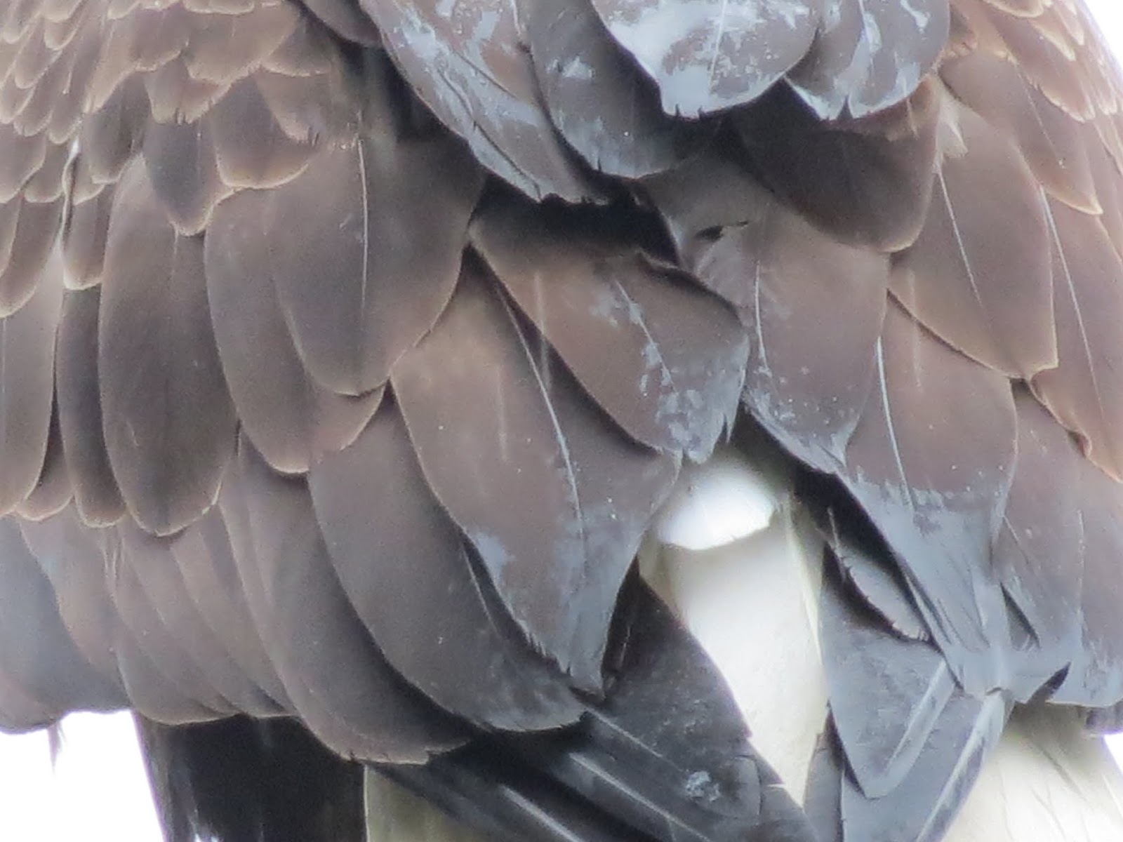
Aiden found an eagle feather and then I found another two. We also found a pile of sheep bones and a skull from a wood pecker (I think). Very exciting day!
We are on our way to Comox Harbour to drop the kids off, then we will try to make it across to the Savory Island for the night. We might have a few days coming up with no internet, probably not until Port McNeill.

Tuesday, June 26, 2012

Nanaimo to Jedidiah Island

Tuesday June 26, 2012
Lv Nanaimo Harbour 8:30a
Fuel: 52 lt 2029 hours
Water: both tanks full
Ar: Jedidiah Island 1:30p

NW Winds 10 -15 knots this morning, made for a bumpy ride. Two of our crew were sick, the third has a stomach of steel. All three got fell asleep for awhile, so things were very quiet around here for a good hour or so.
We are going to go ashore on Jedidiah to see if we can find the wild sheep while we burn off some extra energy.

Monday, June 25, 2012

Monday June 25, 2012
Eagle sitting in our tree after the rain stopped.

The last bit of packing is happening this morning, loading up the fridge and freezer. We are leaving about 12:30 to catch the slack in Dodds Narrows. The weather is co-operating, looks like we will have a nice sail tomorrow as we leave Nanaimo and head over to Lasquiti.

Sunday, June 24, 2012

I have been waiting a LONG time for this....


We'll be on the water tomorrow!

June 24, 2012

Just having some fun with the camera... but seriously, this is a picture of our stern... we now have our home port on our boat. Finally after all these years, we decided it would be a good idea to have where we hail from. This nice looking decal was professionally made for us by wallSAYtional Vinyl Art and Decals .

Jerry is getting the kayaks on board, making sure they are strapped on good and tight. Most definitely one of our very favorite things to do when we are "out there" is to kayak around all the little nooks and crannies, very quietly, and it is amazing what we get to see.

Saturday, June 23, 2012

Haida Gwaii here we come!

Saturday June 23, 2012


So begins another journey! Well almost. We are just about ready to shove off, we will be leaving our home dock on Monday a little after noon. Splendid Mane is ready... she has had her bottom painted...

prop greased and polished, new zincs and .....

we have installed a new Dickinson propane heater! Yay!! Finally we will have all the heat we need to stay toasty warm.  Above you can see the chimney cap next to the mast. 
Our aim this summer (if it ever arrives) is to sail up the west coast to Haida Gwaii (formerly Queen Charlotte Islands) and spend a month there and then plan to be back home beginning of September or so. I have packed enough provisions to last us about 70 days more or less.  We are going to be trying some different tastes this summer... sea cucumber, sautéed bull kelp, and maybe some Dead Man's Fingers if we can find some nice fresh ones. Where we beheading there should be lots.
We are looking forward to meeting up with family out of Bella Colla and having our cousins on the boat for a few nights.
Keep posted, we will try to post everyday if possible when we are within internet range.
Cheers!

Monday, May 7, 2012

Finishing up summer 2011

Wednesday August 31 - Sept 4, 2011
Leave Bush Islets, Johnstone Strait
Arrive Home, Ladysmith Harbour
via: Owen Bay Sonora Island, Open Bay Quadra Island, Tribune Bay Hornby Island, Nanaimo Harbour Vancouver Island.
So, I have been a little lazy with the blog these past few months, and now that boating season is just about here, I thought I would finish up last years posts and the move on.
Coming south through Johnstone Strait, you just never know what you will see. This is the first time we have seen Orca so close, although apparently they are quite common. This group of three was part of a larger pod of maybe 15-20, and they came within about 30 feet from our boat. Very exciting to say the least, I love seeing these beautiful animals in the wild.
We did not run into any fish nets this time, and we really kept a close watch for them. The rest of our trip home was uneventful (possibly why I haven't posted anything! haha), but absolutely beautiful weather all the way. We tried crabbing in Nanaimo Harbour (Steve said we would catch some), but came up empty.
We are currently getting the boat ready for this summer's trip..... Haida Gwaii for a month. We are leaving at the end of June and will be out on the water until early September.
I will try my darndest to keep you posted, I do have some posts ready, so keep a watch on our blog if you are interested in boating.
Cheers!!

Tuesday, March 27, 2012

Back to Bush Islets, Johnstone Strait

Tuesday August 30, 2011
lv Port McNeill
arrv Bush Islets, Johnstone Strait 50 31.11N, 126 27.73W
There are not too many places to hole up while you are transiting Johnstone Strait and since we had a nice anchor in this location going west, we decided to try it again going east. Last time we had the anchorage to ourselves, this time two kayakers have set up camp on one of the islets. Kayaking in Johnstone Strait?.... either you are very brave or very foolhardy. This is not an area I would be inclined to kayak, period!


We enjoyed the company of a pod of porpoise for quite awhile, and I got a few pictures (of water with little splashes) and two videos. The one above is about 1.5 minutes long and is quite fun to watch them dart back and forth in front of our boat. They stayed with our boat for probably close to 30 minutes. So much fun!

Tuesday, February 7, 2012

Oh Happy Day!

Monday August 29, 2011
Leave Miles Inlet
Arrive Port McNeill 50 35.99N, 127 05.27W


MY FIRST SALMON!! SWEET!!
You really have no idea how happy I was in this picture. Un-believeable! And not only one, but here is .......
FISH NUMBER TWO!!
Yes, now I know how to catch a salmon. My ego has gone up numerous notches. Fresh caught salmon on the BBQ for dinner, yumm.
Looking west in Johnstone Strait, heading into Port McNeill, at the setting sun. 

Taking pictures of whales.


This is what my "whale" pictures usually look like, or like......

this (at least there is some action!). But on this particular day......

I managed to get this! And.......

this and.......

 this one and ......

this one!
Mind you, I took close to 100 pictures over about 30 minutes and most of them were of just plain water. It was the most amazing whale encounter we have had. We sat quietly and this whale was up and down feeding on herring all around us. Most of the time we could predict where he would come up because we could see his "bubble net". In one picture, you can see him with his mouth open, catching the herring as he broke the surface.
This is one of the reasons I love getting out on the boat.... these types of experiences you cannot get anywhere else.

Miles Inlet

Sunday August 28, 2011
leave Millbrook Cove
arrive Miles Inlet 50 04.04N 127 47.44W
The rocks here are exposed to the waves in Queen Charlotte Sound.

This is at the entrance to Miles Inlet, a place we have always passed by. But this time we were a little ahead of schedule and we thought it looked like an interesting place to explore. Miles Inlet is almost shaped like a capital letter I, with a few extra nooks and crannies added for good measure. There is three reversing waterfalls inside the inlet and not a lot of places to anchor. But, with only one other sailboat in the inlet, we had lots of room.
We got settled in and then put the crab trap down to see what was available on the bottom. Thirty minutes later, we hauled in 2 very nice rock crab. All in all, we caught three keepers, and let the other 20 or so go.
After dinner, we kayaked over to the reversing falls for a closer look. On the way, we stopped to chat with the other boat, a couple from Seattle. They shared their method of catching salmon off a sailboat, said they pretty much have been living off the sea all summer long. Sounded promising, but anything does since I have not managed to catch even a single salmon, although I am not too bad catching rock cod. We will give it a try tomorrow.

Reversing waterfalls, always worth checking out.

Saturday August 27, 2011
leave Joe's Bay
arrive Millbrook Cove, Smith Inlet 51 19.67N, 127 44.16W
Jerry winding up his anchor trip line in a sea of foam in Joe's Bay.
Yesterday, in Joe's Bay, we went back to the reversing falls after dinner in the kayaks. It wasn't that big of a tidal change, but it was cool to see. Then early this morning, we could hear the roar of the falls picking up and by the time we were pulling the anchor, the little bay was full of foam from the action of the waterfalls.
The bay was super calm and you can see in the picture above our trail through the water as we left.
Onward!

Sunday, January 8, 2012

I love this picture........

Lion's mane jelly fish in Pruth Bay.

Joe's Bay

Friday August 26, 2011
leave Illahie Inlet
arrive Joe's Bay, Fish Egg Inlet 51 38.94N 127 45.58W

Splendid Mane tucked up against the shore in Joe's Bay.
We don't know who Joe is, but his little bay sure was nice. After we got anchored and stern tied, we got in the dingy to explore. In our guide book, it says there is a reversing falls behind the islet we can see in front of us. So we motor over to have a look, and it just so happens that tides levels are about even, so we continue on for some more exploring. After about 10 minutes of slowly putting along, the inlet began to narrow and lots of little islands dotted the landscape. We stopped on one, and built a small Inukshuk.... should be fun to see if it is still there when we go back, maybe this summer.
One of the small islets in Fish Egg Inlet.
Back on Splendid Mane, we enjoyed our afternoon happy hour. As we were quietly sitting in the cockpit, we began to hear some noises coming from the shore..... grunting and snorting and huffing. We never saw it, but it definitely sounded like a bear, upset that someone else was in his bay. 
What is this?

Illahie Inlet off Fish Egg Inlet

Thursday August 25, 2011
leave Pruth Bay
arrive Illahie Inlet off Fish Egg Inlet 51 39.92N 128 49.08W
This is another stop that very few boats make. It is a series of little dead end inlets virtually untouched by anyone. We explored around a few before we settled on a nice location for the night. The weather has been co-operating lately, and we enjoy a beautiful sunset with our dinner.

Tuesday, December 27, 2011

Back to Pruth Bay

Tuesday August 23 and 24, 2011
leave Bremner Bay
arrive Pruth Bay 51 39.24N 128 07.44W
This cheeky raven was looking for a handout.
So here we are back in Pruth Bay. If truth be told, we came back looking to catch s**t load of dungeness. We put the anchor down on the opposite side of the bay this time, then put out the crab trap (with a salmon head) and waited an hour or so. Pulled up the trap, nothing. So put it back and waited again.... trap up, nothing. Maybe all the crabs really are on the other side. The next morning, we pulled up the anchor and went to the other side, exactly where all the crabs were last time. Put the trap down and got in the dingy to head over to the beach.
West Beach, Calvert Island
This is our third time on this beach, and this time we turned left instead of right and walked a couple miles all the way to second beach. It is a beautiful coast line, with unbelievable beaches, definitely worth the walk. 
This was either third or forth beach.
These were on the side of the trail, but not sure what type they are. I can't help it, I love taking pictures of mushrooms too!
Now, back at the boat, we pulled up the crab trap again, and yes, you guess it, nothing!! Oh well, we still love coming to this spot and will come here again, crab or no crab!

Kildidt Narrows and Inlet

Monday August 22, 2011
leave Spitfire
arrive Kildidt Lagoon, Gnat Group then move to Bremner Bay 51 50.80N 128 06.78W
Looking glass water just at the eastern end of Spitfire Channel, going into Kildidt Sound.

Halfway inside Kildidt Inlet.
After pulling up anchor in Spitfire Cove, we carefully navigated our way through Spitfire Channel, the beginning of which is only 20 feet wide and a least depth of 6 feet at a zero tide. To add to the difficulties, there is a tree overhanging the entry by about 10 feet. So, we chose high tide to go through, but even with the extra room, it was probably the tightest narrows we have been through. Coming out the other side into Kildidt Sound, the water was so smooth, we felt like intruders into another world. 
Without hesitation, we decided to carry on through Kildidt Narrows and explore Kildidt Inlet. We did not see any other boats nor any evidence of people, as in logging, float homes, roads or garbage. If you want a feeling of isolation, this is the place to be. It was just us and the seals. 
Brown water from the cedar trees.
We anchored near the Gnat group of islands, got in the dingy and headed back to the narrows for a look at low tide. The water in the inlet is stained brown from all the run off from the cedar trees, but as we got closer to the narrows, it cleared up and we could see the bottom.....
If we wanted sea cucumber for dinner, we would have had no problem getting enough to feed a crowd.
As you have read before, I love taking pictures of the underwater life, and here it was beautiful of course. We also spotted a colony of sea pens growing on a sandy spot in about 15 feet of water, but I had trouble getting a good picture because the current was pushing us around too much.
Back at the boat, we decided to pull anchor and head back out through the narrows and find a more sheltered spot for the night which is why we ended up in Bremner Bay. The boat we were anchored with in Spitfire was already there, so I guess we both had the same idea. We slept nicely.
Monday, December 26, 2011

Spitfire Anchorage... some history from WWII

Sunday August 21, 2011
leave Superstition Cove
arrive Spitfire West Cove, Hurricane Island 51 51.51N, 128 12.27 W


After the rocking and rolling from the previous night, we decided to snuggle into a nice calm cove. We picked Spitfire Cove on Hurricane Island because it said it was snug in the guide book (Cruising the Secret Coast). Another boat had the same idea, but we managed to fit in okay. True to it's word, the book was right and we enjoyed a very calm night.
The islands in this area are named after air force planes from WWII. There is a ruin of a radar station from the 1940's on Spider Island. We didn't stop since we were not having the best of weather, but it definitely deserves a look on another trip, maybe we will be back there this coming up summer.

Back at it after the Christmas break....

Saturday August 20, 2011
exit Kinsman Cove
arrive Superstition Cove, Hunter Island 51 53.52N, 128 14.46W

This area is starfish heaven, in every colour you can imagine.
I know it has been awhile since my last post, but seriously, I have been busy doing the Christmas thang. But now that we are more or less back to normal around here, I feel like I really should finish off our trip this summer, at least before we take off again on another journey!
Nice thing about blogging about our trip now, is that I get to almost relive all the fun times we had.... such good memories.
So, our next stop was Superstition Cove as we made our way south along Hunter Island. The cove is somewhat exposed to the west but we thought we would give it a try. We had it to ourselves and it seemed to be a nice enough anchorage, but as luck would have it, the wind picked up a bit and we ended up having a rocky night. A little bit of rocking is okay, but this was too much and neither of us got a good nights sleep. We didn't do any exploring here as the weather was not that great. In nicer weather, this would be a place to stay a couple nights.