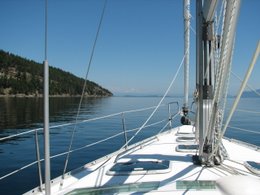
This picture shows what happens in the middle of a channel when the tide, coming from both directions through the channel, gets together and has a party with the wind. This can be a very dangerous situation for small boats or kayaks.
July 29, 2007
Time 0845 Hrs: 1056.5
It is raining today.
Lv: Ikeda Cove
Course: Hecate Strait > Houston Stewart Channel going west >
Today we visit the last of the Haida sites. SGang Gwaay was declared a World Heritage Site by UNESCO (United Nations Education and Science Organization) in 1981. The island is located on the exposed southwest coast of
Our boat is still in the same place we left it :- ) even though the swells have gotten bigger. We have to head back to the east side to find a sheltered anchorage and a good starting point for our big crossing tomorrow.
Avr:
Lat: 52 05.80 N
Lon: 130 57.91 W
Time: 2015
Trip: 38.4 nm Log: 4257.8 nm
Thursday, August 2, 2007
Tidal flow in Houston Stewart Channel
Labels:
Alaska 07
Subscribe to:
Post Comments (Atom)


No comments:
Post a Comment