Showing posts with label Barkley Sound. Show all posts

Sunday, July 19, 2009

Refuge Island to Dodger Passage


Black bear near our anchorage at Refuge Island.

Saturday & Sunday, July 18-19, 2009
Leave: Refuge Island 0945
We stayed two nights at Refuge Island because it was such a perfect anchorage. It was quiet, protected, scenic and great kayaking. Friday night we took the dingy up a small inlet to the end and discovered a beautiful river emptying into the inlet with waterfalls and pools. So, Saturday morning we took our towels and soap and headed up in our kayaks for a swim and a bath! It was wonderful!

Today we have had some discussion about whether or not to head out of Barkley Sound today or stay one more night. The winds are favorable for a trip today, but it is getting late to get started. Tomorrow the forecast is for light winds, not the best scenario. We are still undecided... tune in later for more details!
The verdict is in, we are staying one more night.
Arrive: Dodger Passage, 1600
We had a great afternoon sail across Imperial Eagle Channel, with winds up to 22 knots. We are settled in for the night now, the wind has mostly clamed down. We will get a very early start in the morning...... probably about 5:30 to head down Juan de Fuca to Port Renfrew or further if things are going our way.

Friday, July 17, 2009

Pinkerton Islands to Refuge Island


Improvised hummingbird feeder...
The hummers were so aggressive in this anchorage (flying right into our cockpit, trying to find something to eat around my head, etc), we finally decided to give them something to eat. The beer can has sugar water in it, I poked a hole in the side for them to feed from. I had to catch three of the little buggers to get them out of our cockpit, they kept flying in to find something to eat and then couldn't figure out how to get back out!

Friday July 17, 2009
Leave: Pinkerton Islands, 1430
The Frances Barkley taking a load of tourists to Ukee. Can you see the sailboat just coming out of the fog?

Arrive: Refuge Island, 1615
Lat: 49 01.63 Lon: 125 18.80
The scenery here is absolutely gorgeous ! On one side we can see the high mountains of Vancouver Island and on the other side looking west we can see little islands in the bay and the setting sun behind. We had 15 knots of wind today, but right now it is very calm. We are going touring in dingy after dinner and maybe try a little fishing. We saw fish jumping in the bay before we put down the anchor.

Thursday, July 16, 2009

Robinson Island to Pinkerton Islands


The fog starting to lift while we ate our breakfast.

Thursday July 16, 2009
Leave: 0715
There was no internet reception at our anchorage, so we have hit the water early to hook up again to see what is happening in the world! Same old stuff, really!
The fog is very thick, and we are using radar and our gps to guide us. We stopped to have breakfast close to Canoe Island, then continued on and found a nice anchorage in the Pinkerton Islands.
Arrive: 1215 Pinkerton Islands, north side of Broken Group
Lat: 48 57.55 Lon: 125 16.75
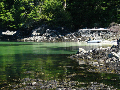
This is a very quiet little anchorage, with beautiful green water. It is super clear, we can see down maybe 20 feet! Kayaked around the Pinkerton Islands, it is pretty here but not as much to see as yesterday. We are looking forward to the sunset tonight, hopefully if the fog does not come back.
I played around with the colour on this picture on the trees, but the water is the same.

Wednesday, July 15, 2009

Bamfield to Alma Russell Islands


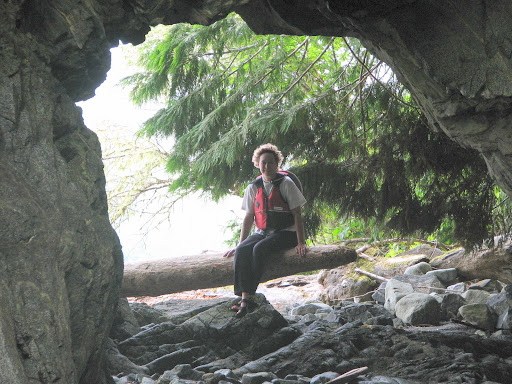
Cave on Robinson Island.

Leave: Bamfield 0830
Woke up today and the fog has rolled in again but the forecast is for clearing and some wind this afternoon. Rick and Rosita jammed out on our sailing trip today because of the weather, but will take us up on our offer to sail in the Gulf Islands.
We are headed east in Barkley Sound to explore the eastern side which is actually part of Vancouver Island.
Arrive: 1145 Robinson Island, Alma Russell Islands
Lat: 48 57.10 Lon: 125 12.31
Trip log: 155.9 nm
This area is hugging the Vancouver Island Coastline, along the eastern shore of Barkley Sound, close to the entrance to Effingham Inlet. We have tucked in behind Robinson Island, out of the wind if any comes up. The ocean swell has been reduced to pretty much nothing here.
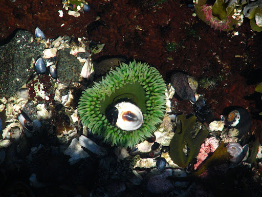
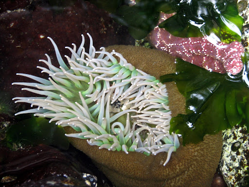
A kayak tour around Robinson Island was a fun adventure, turning up some caves (it was low tide and a little too rough to enter) and TONS of starfish of all kinds. They are so beautiful while underwater, and very difficult to photograph with my camera. It is looking more and more like I am going to need a new camera that is waterproof.

Just before dinner, we headed out in the kayaks again to take a tour of Julia Passage. This is an area that is float home central. Most of the homes are summer only, but a few have year round residents. Very interesting lifestyle. Check out the vegetable garden on the left side of the house.

Tuesday, July 14, 2009

Tzartus Island to Bamfield

Tuesday July 14, 2009
Leave: North Tzartus Cove 1115
We are slowly making our way through Imperial Eagle Channel and then on to Bamfield. Tonight we are having dinner with Rick and Rosita at their house.
Arrive: Bamfield Inlet 1345
Lat: 48 49.51 Lon: 125 08.38
Toured around Bamfielf Inlet in the dingy before heading to Rick's house "Seaview" to have a wonderful fresh (as in a few minutes ago) crab dinner and barbequed salmon. Yummm!

Sunday, July 12, 2009

Tzartus Island


Star fish coat the rocks at low tide.

Sunday July 11, 2009
Leave: Robbers Passage 1430
We are going to explore around the south east corner of Barkley Sound and then anchor on the west of Tzartus Island
Arrive: North Tzartus Cove 1745
Lat: 48 55.16 Lon: 125 06.17
Trip log: 165.00 nm

Saturday, July 11, 2009

Barkley Sound... time to explore!


Getting ready to head out for a kayak around Diana Island in the fog.

Saturday July 11, 2009
We got to sleep in this morning to 7:00! It was very quiet and when we looked outside we couldn't see anything! We were in pea soup fog, but it is starting to life now, the sun is warming the boat up, Jerry is washing the breakfast dishes, and we will be heading out for a kayak shortly as low tide is at 9:45 this morning.

Friday, July 10, 2009

Becher Bay to Barkley Sound, Dodger Channel


Our anchor collected some 'stuff' overnight! This was the biggest glob of seaweed we have ever collected in one short night.

Friday July 10, 2009
Leave: Campbell Cove 0520
We got an early start because we were rudely awoken by all the recreational fishermen zooming by in their boats! Oh well, it was just as well, because then we will just make it a super long day and get all the way to Barkley. It is almost lunch time right now and we are past Port Renfrew and almost even with Cape Flattery on the Olympic Penninsula.
No wind yet and we have the current going with us.
Arrive: Dodge Channel, between Diana Island and King Edward Island 1845
Lat: 48 50.05 Lon: 125 11.69
Trip log: 145.5 nm
Today was a battle from after lunch until we put the anchor down. The winds picked up to 25 knots almost straight on, and the waves were 2 meters. We motor-sailed all afternoon, and are now exhausted and ready for bed! Jerry is already asleep.
Tomorrow we get to sleep in, enjoy some down time and then get the kayaks out!

Wednesday, July 8, 2009

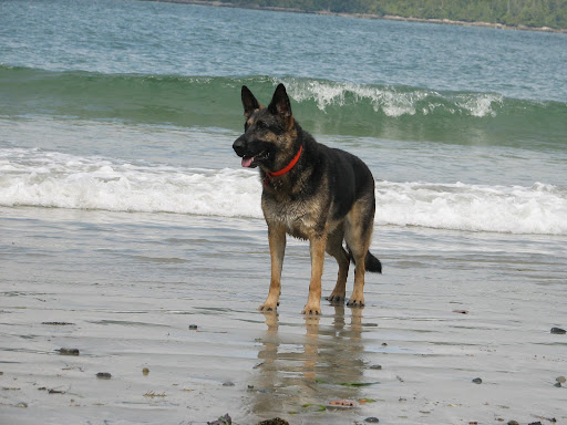
We're off again... to Barkley Sound... Woof Woof


The 7:00 pm ferry leaving Sidney Harbour.

Wednesday July 8, 2009
Leave: Our dock 1245
Trip log: 0.0nm
Our first stop will be fuel and water in Chemainus.
Fuel: 82 lt $76.57 Hours: 1479
Water: both tanks full.
Through Sansum Narrows, around the south end of Saltspring Island to Portland Island.
The winds were either right on our nose or non existant all day, so we have had to run the motor. Once we get the anchor down it will be nice to listen to the peace and quiet.
Arrive: Portland Island, Princess Bay 2000
Trip log: 30.4 nm
Portland Island was given to Princess Margaret (1958) as a gift, but then in 1967 she gave it back to the province to make into a marine park. Another island that is very close by, Brackman Island is a nature reserve created by The NCC.

Saturday, July 12, 2008

Exploring around Diana Island

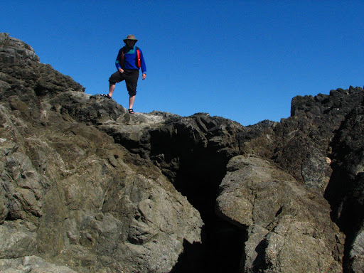
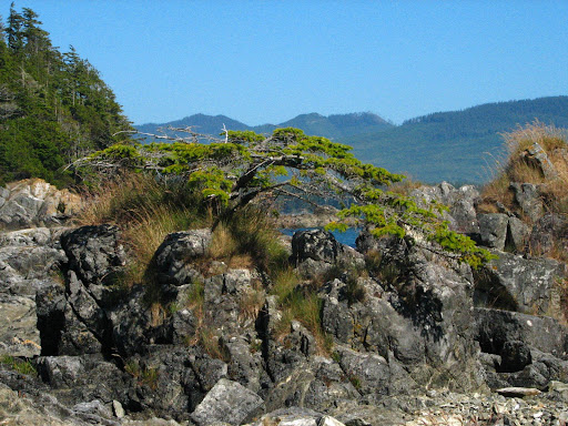
These are some pictures I took while out in the dingy on Friday. We also saw some whales, I am not sure if they were humpbacks or greys, because they were not close enough and were not breaching or spyhopping where you can see their heads. But it was cool, nonetheless! I really enjoy seeing them. We found a cave (Jerry is standing on top of) and a little 'bonsai' tree, and lots of beautiful sandy beaches. All in all, it was a good day to hang around Barkley Sound.


Thursday, July 10, 2008

Into Juan de Fuca


Saturday July 12
Depart: anchorage near Diana Island, Deer Group 0645
Calm, clear, 18 C. Forecast NW winds 10-20 today
We are motoring south right now, heading towards Victoria. We are hoping the winds pick up so we can do some sailing, right now we only have about 2-3 knots, not enough to bother with the sails.
Arrive: Sooke Basin 2135 Lat: 48 22.19 Lon: 123 40.81
Trip Log: 844.5nm Day: 84.5 nm
We had a great sail the second half of the day... winds picked up to 25 ++ knots right behind us and we sailed smoothly all the way to Sooke, reaching speeds of 10 knots on the downside of the waves! We couldn't have asked for a better sail.

Leaving Barkley Sound before the sun got up.

Just before sunrise in the Broken Islands

Sunrise over Vancouver Island
Friday July 10
Depart: Gilbert Island Beach 0545
Calm, 17 C, clear sky
Stop: Bamfield for fuel, 90L @ $1.60 $144.00
Arrive: Dodger Channel, near Diana Island, Deer Group 1035
Lat: 48 49.98 Lon: 125 11.65
Our plan this morning was to head south and arrive in Sooke (about 70 miles) late this evening, but the winds shifted and were very light, not good for sailing. So, we will try again tomorrow, the forecast is for favorable winds.
We are anchored in a small channel between two islands in the Deer Group, just outside of Bamfield. The weather is beautiful and sunny.

Tuesday, July 8, 2008

Gilbert Island, Broken Islands

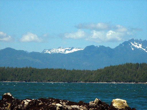
View of snow on mountains on Vancouver Island from our anchorage at Gilbert Island.


Thursday July 10
Depart: Nettle Island anchorage 0900
Arrive: Gilbert Island 1230
Trip Log: 750.7 nm Lat: 48 52.46 Lon: 125 19.21
We did not arrive at this anchorage very gracefully. We shortened our painter by about 10 feet! Or for those of you that don't know boatspeak, the rope that ties the dingy to the boat when you are towing it (called the painter, and don't ask me why), normally behaves quite well when we are putting the anchor down, but on this particular day, it decided the best place for it would be under the boat and around the propeller. Consequently, I had to get in the water, and untangle it from around the prop, but we had to cut it before we could get it off and that is why it is about 10 feet shorter now. Oh well, those things happen!
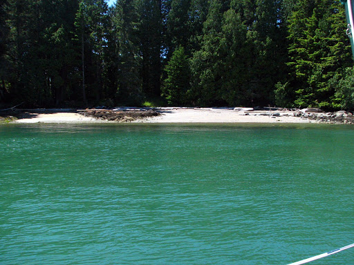
We are nestled in close to Gilbert Island, near a nice sandy beach as the winds howl all around us except for on our little private beach. (Actually it is not really private because this is the kayak campsite.)
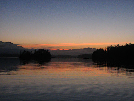
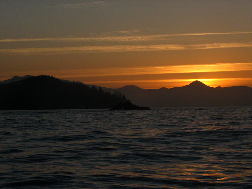
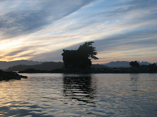
Sunset in the Broken Islands

Nettle Island, Broken Group


Wednesday July 9
Depart: Joe's Bay 0900
Arrive: Nettle Island anchorage 1000 Lat: 48 55.86 Lon: 125 15.40
Trip Log: 742.9 nm Trip: 3 nm
Quick trip today to re-position ourselves for more kayaking exploring. We are near Nettle Island, the northern most island of the Broken Group. The day turned out to be another beautiful day after starting with thick fog. It is actually getting pretty hot, over 30 in the sun. On our kayak tour, we came across a cave that would normally have been mostly flooded except for the fact it was low tide.

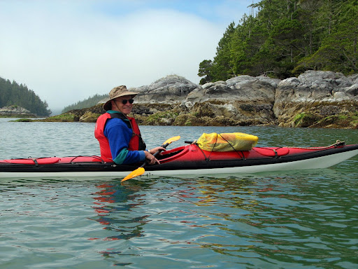
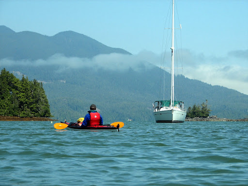
Kayaking in the Broken Islands, Barkley Sound

Splendid Mane in Joe's Bay near Dodd Island
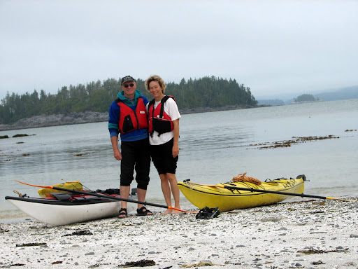
Our first stop on Trickett Island
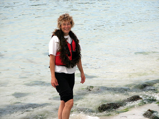
Seaweed feather boa.

Tuesday July 8
We are staying put today, getting the kayaks in the water to do some exploring around the Broken Islands. Low tide was at 11:00 this morning, so we tried to get out on the water to a little before that to be able to see below the tide line. Jerry said he likes high tide better because then you can see what is on the beach. The winds started to kick up in the afternoon, but we were on the up wind side away from our anchorage, so it was a nice ride back to the boat, surfing down small waves and just letting the wind carry us all the way back.

Visiting Bamfield

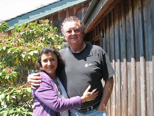
Rick and Rosita at Seaview in BamfieldYoshi, Rick's dog, waiting for us to throw her a stick.
Monday July 7
Depart: Bamfield Harbour 1420
Arrive: Joe's Bay, near Dodd Island, Broken Islands Barkley Sound 1845
Lat: 48 55.08 Lon: 125 19.62
Trip Log: 738.5 nm Day: 17 nm
We had a wonderful visit yesterday and today with Rick and Rosita. They treated us to dinner, sleepover, breakfast, and lunch. And we finally got to meet Rosita whom we have heard so much about. Rick even went out and caught us a fish for dinner! After lunch, Rick took us back out to Splendid Mane, and we sailed over to the Broken Islands... a perfect sail with just the right wind.

Sunday, July 6, 2008

Barkley Sound


Splendid Mane got her first taste of some pretty good swells today... mostly in the neighborhood of 5 meters. We had a beautiful sail down from Tofino to Ukee, this is what we have been waiting for!
Sunday July 6
Depart: God's Pocket 0730
Winds 10-20 knots, mostly clear sky, 18 C
Arrive: Ukee 1500
We took a quick tour around the inlet and then decided to move on towards the Broken Islands in Barkley Sound. Sent a quick email to Rick (in Bamfield) and he has invited us for dinner and then to sleep at his house tonight! So we are heading for Bamfield right now and should be there about 6:00 or so.