Tuesday, July 17, 2007

Charles enjoying some sun

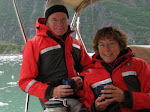
Charles is getting braver everyday. He has started venturing out into the cockpit while we are under way. And when we stop for the day, he always comes out for a look around. It will be fun to see what he does once we arrive back at our home dock!

July 16, 2007
Time: 0945 Hrs: 1012
Humidity: 79% Temp: 17 C Light rain, wind 15 -20 knots, foggy.
Lv: Brundige Inlet, Dundas Island
Course: Chatham Sound > Venn Passage > Prince Rupert Harbour
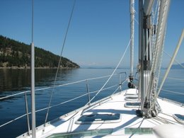
Once we had left the protection of our anchorage, we put up the sails and sailed half way across Chatham Sound before the wind died down. It rained most of the day, but by the time we arrived in Rupert, it looks a little brighter.
Arv: Prince Rupert
Lat: 54 19.54 N
Lon: 130 18.36 W
Time: 1700
Trip: 34.1 nm Log: 4011.0 nm
Fuel: 136 L $163.60
Oil Change: Hrs 1018.9
On the way in, we listened to other boaters on their quest for moorage here. Prince Rupert has limited dock space, and we figured the dock we stayed at last time would be full. After we filled up with fuel, we motored over to the marina, and surprisingly we found a space, the exact same one we had last time we were here in June. Another sail boater helped us tie up, and told us several 60’ + power boats had tried to squeeze into this space… sometimes it is just better to have a smaller boat! The sun is shinning and it is warm (22 C)…. a good time to open up all the hatches and give the boat a good airing and dry things out. We are going to stay in PR tomorrow and then be on our way to the Queen Charlotte Islands on Wednesday. We are hoping for a favorable wind to get us there!

Prince of Wales Island as the fog lifts.


July 15, 2007
Time: 0700 (Alaska time)
Hrs: 1001.4
Humidity: 66% Temp: 16 C Overcast, foggy, calm.
Lv:
Nichols Bay
Course: Dixon Entrance > Dundas Island, BC
We were really hoping to have some wind today to cross Dixon Entrance but it looks like we will be motoring all the way. Maybe it will pick up this afternoon so we can sail.

Arv: Brundige Inlet,
Dundas Island
Lat: 54 35.62 N

Lon: 130 52.14 W

Time: 1930 (BC time)

Trip: 46.0 nm Log: 3976.9 nm
The wind finally picked up as we approached Dundas Island and we got in some nice sailing in 20 knots, got the boat to just under 8 knots. We are anchored in almost the same spot as the last time we were here. We have now made a full circle. Glad to be back in
Canada, but sad to be leaving Alaska which has been a wonderful place to explore. We'll be back!

Charles has a new spot...

Charles likes to curl up here on the steps because it is warm from the engine. Also because it is right in the way!

July 14, 2007

Time: 0930 Hrs: 995.6
Humidity: 67% Temp: 19 C Foggy, cloudy, raining.
Lv: Middle Island, Barrier Island Group
Course: Cordova Bay > Dixon Entrance > Nichols Bay
Arv: Nichols Bay, Prince of Wales Island
Lat: 54 43.24 N
Lon: 132 08.31 W
Time: 1450
Trip: 17.8 nm Log: 3930.9 nm
As we were coming into this anchorage, we noticed lots of prawn traps out. So, we get the trap ready, and head out in the dingy, put it down in about 250’ and then do some exploring around the shore. Of course, we find more fishing floats and nets. This bay has twice as much garbage as the last one! I thought it was bad there, but man; Alaska really should have a beach clean up. This is really terrible, we never saw anything like it in BC. We salvaged 4 floats, and over two hundred feet of rope, still in good condition.
After dinner, we go check the trap, and after only 4 hours, we have 18 prawns! Looks like we will be having prawns tomorrow.

Finally our first crabs


July 13, 2007
Time: 0925 Hrs: 988.0
Humidity 74% Temp: 18 C, Overcast, no rain, light winds.
Lv: Dunbar Inlet
Course: Tlevak Strait > Cordova Bay > Barrier Islands
Pick up the crab trap, and lo and behold, we finally hit the mother lode! Four nice Dungeness, three of them big males. We’re having crab for dinner tonight, doo daa, doo daa! Friday the thirteenth is our lucky day, unlucky for the crabs, but they did have a nice last meal.
Arv: Middle Island, Barrier Island Group
Lat: 54 48.61 N
Lon: 132 26.21 W
Time: 1630
Trip: 28.5 nm Log: 3913.1 nm
After dinner of crab on pasta and a big green salad, we are off to do some exploring around the bay. We spot a couple floats (the kind used on crab or prawn traps) washed up on the shore, and thus starts a new hobby for Jerry….. beachcombing. This area has lots of stuff on the beaches, mostly from the fishermen….. netting, plastic containers of all sizes, floats, and rope. From a distance it is hard to see, but once you get up close you realize the amount of garbage is almost unbelievable.

Fishing tackle in Craig


July 12, 2007
Time: 1000 Hrs 980.8
Humidity: 65% Temp 20 C Low lying fog, clear sky, no wind.
Lv: Craig
Course: Klawock Inlet > Ulloa Channel > Tlevak Strait > Dunbar Inlet
We are heading south down the west side of Prince of Whales Island. It will take us two days of travel to get to the southern tip of the island. So tonight we will find a quiet anchorage and try our luck at some fishing or crabbing again. I got some more advice on how to catch a halibut… we’ll give it a try and see what happens.
We stop to wait for the tide to turn just before Tlevak Narrows. With my new halibut hook, I put out the line, down to about 10 feet off the bottom. Within about 10 minutes, we have a fish on the line, it is a big one, he is pulling the hook under and around the boat, and I am having trouble reeling in because he is so big, and Jerry gets the net ready, and I am reeling hard trying to keep the line tight, and then the line goes slack! Okay, no problem… I have more bait, put out the line again, circle the boat around to the same spot, but this time all we catch is rock cod, three altogether. We get them cleaned and ready for the BBQ. But I am still mad about the one that got away.
Close to our anchorage, we put the crab trap down with a salmon head and some anchovies. Looks like a good place as there are lots of other traps (commercial fisherman). We are the only boat, there has been very little traffic on the water all day, and all of it was commercial fishermen.
Arv: Dunbar Inlet, Sukkwan Island, on the west side of Prince of Wales Island
Lat: 55 05.18 N
Lon: 132 50.05 W
Time: 1930
Trip: 32.4 nm Log: 3884.6 nm

Fog in Craig Harbour


July 11, 2007
Craig is a small town of about 2100 people. You can walk from one end to the other in about 15 minutes. So we didn’t bother with our bikes being that it takes us 15 minutes to unload them and put the front wheels on. We started off walking to the library (for their internet service), then stopped at a really nice little coffee shop/ book store. Their internet was much better than the library, and their halibut chowder was awesome!
After lunch, we took care of some domestic chores (laundry, grocery shopping). That seemed to take up the rest of the day and after dinner we enjoyed chatting with another boating couple (the ones from Ft Lauderdale/ New York that we met in Petersburg) about cruising to the Queen Charlottes and so on.

Wednesday, July 11, 2007

Navigating through El Capitan Passage


It is hard to tell from this picture (because it was raining so hard), but there are 7 navigational markers in this area about 1/4 mile in length! They are red and green, and if you go outside the markers you WILL hit the bottom.

July 10, 2007
Time: 1030 Hrs: 972.8
Humidity: 80% Temp: 16 C Rain, rain, rain.
Lv: Sarkar Cove
Course: Sea Otter Sound > Karheen Passage > Gulf of Esquibel >San Christoval Channel > Craig
More whales as we leave Sarkar Cove just before we enter a narrow channel between two islands. They are everywhere! We have to slow the boat down to make sure we are not interfering with them, but they are fascinating to watch. It has been raining steady all day, we did get the mainsail up for a bit of sailing through it all.
Arv: Craig, Prince of Wales Island
Lat: 55 28.76 N
Lon: 133 08.62 W
Time: 1830
Trip: 37.0 nm Log: 3852.2 nm

We are in Craig at an internet coffee shop. Just finished a bowl of their locally caught halibut chowder...... very yummy. Now back to the docks to see if we can find some prawns for dinner. Next internet opportunity will be PR (Prince Rupert). Ciao!!

Humpback feeding on herring.


July 9, 2007
Time: 0830
Humidity: 70% Temp 16 C Drizzle calm.
Lv: Point Baker
Course: Sumner Strait > El Capitan Passage > Sarkar Cove
Upon waking this morning, we had a look around Point Baker. Not much here except a fishing lodge, fuel dock and post office along with the required derelict squatter boats (most have anemones growing on their hulls). As it turned out, we were tied up on the public float next to the local bar. My cold is still hanging on, I don’t feel any better.
The weather forecast for today is for a 100% chance of rain. I don’t understand how you can have a 100% CHANCE of rain. Seems like an oxymoron. Anyway, it is raining now and it doesn’t look like it will let up anytime soon. As we are entering El Capitan Passage, we pass two humpbacks feeding on herring. We slow down to watch for a few minutes, and then notice that lots of salmon are also feeding on the herring. And there are sea birds of every kind everywhere; everyone is having a good feast today!
Arv: Sarkar Cove, Prince of Wales Island
Lat: 55 57.36 N
Lon: 133 14.80 W
Time: 1615
Trip: 35.6 nm Log: 3815.2 nm
It is still raining (hard) as we put our anchor down. If nothing else, our boat is getting the salt washed off! A very nice quiet anchorage, we have two Alaskan p.b. (power boats) for company.


July 8, 2007
Time: 0710
Humidity: 64% Temp: 13 C. Overcast and very light rain.
Lv: Warm Springs Bay, reluctantly
Course: Chatham Strait > Frederick Sound > Rocky Pass > Keku Strait > Sumner Strait > Point Baker
I feel like I am catching a cold, but hopefully it won’t last long. Jerry has a bit of stuffiness too. We have to get fuel, so our first stop will be Kake and then from there we will decide where to go. There is no point in taking any pictures this morning because everything is the same colour. The water and sky are all grey, it is hard to tell one from the other.
On this trip, Jerry really has taken most of the responsibility of captain, since he does most of the driving. But we decided I needed a new title, so as of today I am now the CHO, or Chief Head Officer. Only another boater would find this amusing.
Fuel Stop at Kake: 35 US Gal (32.7) $145.90 Hours: 956.5
As we left Keku Strait, the sky lit up with the most beautiful sunset! I tried to capture it with the camera, but nothing can compare to the real thing. I said to Jerry, that it was the prettiest sunset we have seen on this trip, and then remembered we haven’t seen more than one other because they happen so late and we are always sleeping!
Arv: Point Baker
Lat: 56 21.30 N
Lon: 133 38.31 W
Time: 0025
Trip: 71.0 nm Log: 3780.3 nm
Finding a place to tie up in the darkest part of night where you have never been before was a challenge. Fortunately, with our spotlight that we bought just for a circumstance like this, we were able to pick out landmarks (with a few close calls!), and tie up at what we figured was the public dock and not a private one. If we had been another hour or so, we would not have had a problem because the sky was starting to lighten.

Warm Springs Bay


July 7, 2007
We slept in today until almost 9:00! This is going to be a day of relaxation as our plan is to head over to the little “town” in the dingy and have a soak in the hot spring and then take a nice long bath in the bath house. This is another community with no roads, just boardwalks. The general store is apparently only open when the owner feels like it. Today is not one of those days. We continue on just a short 10 minute walk out of town and find a beautiful hot spring right next to the rushing river. I was thrilled, Jerry didn’t like all the gunk in the water! But it felt soooo nice, our legs had trouble taking us back to town. We stopped to chat with the resident caretaker. He told us they had 34 feet of snow this past winter. That would explain why we can still see snow down next to the water in some places. His main job in the winter is snow removal from all the boardwalks!
Before heading back to our boat, we stop at the community bathhouse. There are three rooms, each with a large tub being constantly filled with water from the hot springs. As you soak in the tub, you can look out over the bay towards the surrounding mountains covered with snow. Ahhhhh, this really is a nice place and one that I would come back to in a heartbeat. Jerry and I soaked until we couldn’t take the heat anymore.
We slowly made our way back, feeling that nothing could be better at this very moment. We did some more exploring in the rest of the bay and come across a brown bear feeding on grass. At first we surprised him, but then he became unconcerned and continued to eat. I was able to get some great pictures.
Back at the boat, we feasted on BBQ’ed salmon, greek salad and rice pilaf with tea and date bars for dessert.
It’s not where we go, it’s the journey we take.

More Baranof Island


July 6, 2007
Time: 0700 Hrs 944.1
Humidity: 74% Temp: 14 C. Cloudy, wind 10 knots.
Lv: Appleton Cove
Course: Peril Strait > Chatham Strait > Warm Springs Bay
We had to motor through Peril Strait and then a few miles into Chatham Strait because the wind was coming straight at us. We finally picked up a nice 15 knot wind and put up both sails to make our way down the east coast of Baranof Island. We kept having to tack out of the way of fishing boats and their picker boats.
Arv: Warm Springs Bay
Lat: 57 05.32 N
Lon: 134 48.12 W
Time: 1825
Trip: 45.8 nm Log: 3708.3 nm
The public dock and the area close to it are full with fishing boats. Tomorrow night is the opening for salmon fishing and these boats are getting ready to go out. Closer to the entrance to the bay is a small one boat cove called Schooner Cove. Lucky for us, there is not another boat there, so we put our anchor down and enjoy a nice quiet evening. We decide that this would be a good place to spend an extra day.

Baranof Island in the clouds


July 5, 2007
Time: 0820 Hrs: 934.9
Humidity: 77% Temp: 17 C Drizzle rain. Light wind.
Lv: Sukoi Inlet
Course: Salisbury Sound > Peril Strait > Chatham Strait > Appleton Cove
Once we get out into Salisbury Sound the wind starts to pick up a bit. We spot a humpback feeding close to shore just as we enter Peril Strait. They are all over, but I don’t get tired of watching. We had to time our departure today to arrive at Sergius Narrows at slack tide. The currents run high through a very narrow dredged opening about 400 meters long. Even though we consulted two tide charts, we arrive at the narrows and the current is flowing pretty fast and pushes us through at over 12 knots. That was exciting! And yours truly was navigating!
Arv: Appleton Cove, Baranof Island
Lat: 57 28.16 N
Lon: 135 16.50 W
Time 1450
Trip: 27.8 nm Log: 3662.5nm
We had planned to make it another 15 miles today but the wind, rain, waves and current decided that we would tuck into a anchorage sooner. We check our chart; Appleton Cove looks inviting, but we cannot find any information about it in any of our books. One other boat is anchored already when we arrive. A few hours later, our little anchorage has 14 boats (we are the only sail boat) and the wind is still howling. Seems lots of other people had enough of fighting the weather today.

Would ya look at that?....


July 4, 2007
Time: 1030 Hrs: 929.7
Humidity: 73% Temp: 18 C Overcast with no wind in Sitka Harbour. The weather forecast for the next couple days is calling for 10’+ waves and 25 knots in the Gulf.
Course: Neva Strait > Salisbury Sound > Kalinin Bay, Kruzof Island
Instead of heading south down the outside of Baranof Island, we will back track a short distance and head through Peril Strait to the eastern side of the island and then south through Chatham Strait.
Just as we were leaving Sitka Harbour, we heard our first Mayday call on the radio. It was from a 39’ sailboat that had hit a rock (sounds familiar) about 15 miles south of Sitka. As it turned out, he was not in grave danger as he was able to back off the rock and he was not taking on water. It was a good learning situation for us though by listening to the conversation.
Arv: Sukoi Inlet, Kruzof Island
Lat: 57 16 77 N
Lon: 135 40.92 W
Time: 1550
Trip: 20.1 nm Log: 3634.6 nm
We stopped just before Sukoi Inlet to try our luck at a little bottom fishing, and wouldn’t you know it!, we were lucky and caught a nice Quillback Rockfish. Not much of a fight, but fun to catch none the less! We get to open another present tonight from Walter and Mavis!
The wind was howling and the rain coming down in buckets just when we were trying to anchor. After getting the anchor down, we decided that we would move after the rain slacked off because we were in too shallow. Second time we were successful, the rain has slacked off but the wind is still 20 knots.

Fourth of July, 2007


HAPPY BIRTHDAY VINCE!! (our 3rd son, currently on a working vacation in Thailand)

We are currently in Craig, Prince of Wales (Whales!) Island, Alaska. There are humpbacks everywhere you look. We arrived here last night and will be leaving tomorrow. It has been awhile since my last post because we took a round about route to get here stopping here and there for this and that. But all is well, except I can't get my computer to connect to the internet (I am using the library internet right now, but their wireless won't work with my laptop). So I can't put up any pictures, although I have some really great ones we want to share. So, our next post (unless I get the laptop to work) will be when we get to Prince Rupert in about 4 days. Back in CANADA already! I have read everyone's comments, thanks for all of them, it puts a smile on our faces. We miss you all too! I can hardly believe we have been gone from home almost 9 weeks now!
Cheers, Love Kathy and Jerry

Tuesday, July 3, 2007

Charles's has a relaxing day.


July 3, 2007
Don't you think he looks like he is enjoying himself? Charles also enjoyed helping us eat our dungeness crab dinner tonight, and he even liked the olive oil, butter and pesto sauce I made to dip it in.
We are still in Sitka, but will be leaving tomorrow morning. We are heading over to the other side of Baranof Island. We will be out of touch for about 4 or 5 days. Until then..... !

Some needed maintenance....

July 2, 2007
On most boats, things are a lot smaller than in a house and when it came to cleaning out the dust from the air intake to the refrigerator condenser, it took Jerry most of the morning to get the screws out and then contort his body into the small space to do the job.
Afterwards, we did some laundry and a short bike ride up island. Sitka only has 17 miles (total) of roads, but everyone here has a car. Most of the roads are good, but close to town they are very narrow, hardly room for two cars and a bike. It is a nice little town to visit, lots worth seeing, but they should encourage residents to use the public transit or bikes more. I mean really, with only that much road to drive on, don't you think you would get board pretty fast of driving your car?

Monday, July 2, 2007

Sitka on Canada Day


July 1, 2007
Time 0810 Hrs: 920.5
Humidity: 81% Temp: 15 C Overcast and very light rain, calm.
Lv: Klag Bay
Course: Khaz Bay > G of A > Salisbury Sound > Neva Strait > Sitka
We don’t have enough wind to sail today, so we motor along. The swells from the ocean make travel somewhat uncomfortable as we rock back and forth. Once we turn into Salisbury Sound, the ocean swells, wind and current work to our advantage and push us along smoothly.
Arv: Sitka Harbour
Lat: 57 03.54 N
Lon: 135 21.29 W
Time: 1710
Trip: 42.1 nm Log: 3614.5 nm
We pull in and right away meet some local boaters. They are super nice here, and almost tell us their life story before we are even finished tying the boat. Just two boats away are the guys from California, and we recognize several other boats in the harbour as well. Seems like everyone is on the same time table and route. We will stay here a couple days as everyone has said what a nice town Sitka is and not spoiled by the cruise ship industry yet. HAPPY CANADA DAY!

Sunset in Klag Bay

Chichago Island, Ghost town of Chichago


June 30, 2007
Time: 1015

Humidity: 75% Temp 15 C Foggy and drizzle rain.

Lv:
Porcupine Bay
Course: Gulf of Alaska > Imperial Passage > Surveyor Passage > Odgen Passage > Klag Bay
We were going to stay at this anchorage today and go to White Sulphur Hot Springs in our tender, but since it is such a yucky day weather-wise, we decide to carry on. The rain does lift and we get a bit of sun and it warms up to 21 C. Lots of sea otters around here, they are sooo cute!
Arv:
Klag Bay, Chichago Island
Lat: 57 39.74 N
Lon: 136 05.53 W

Time: 1600
Trip: 23.5 nm Log: 3572.4 nm

We are anchored in the head of
Klag Bay where there is an abandoned gold mine. From our boat it looks worth exploring. This turns out to be our lucky day…. I found the shoulder blade from what looks like a sea lion (I wanted to find one from a whale, but this one will do), and we spot a grizzly bear (we were back in the tender, fortunately) and were able to get close enough for some pictures. He was really not too concerned about our presence (since he is at the top of the food chain) as he browsed on grass close to the shore.

Charles goes exploring.

Shootin the s--t in Elfin Cove


June 29, 2007
Time: 1015 Hrs: 910.0
Humidity: 75% Temp 14 C Foggy and calm.
Lv: Elfin Cove
Course: Cross Sound > Gulf of Alaska > Porcupine Bay
As you can see from the picture, things are pretty busy around the dock with all the boats coming and going as well as float planes. The fog lifted after we got out away from the shore and the sky started to clear off. We got some sailing in for most of the day, zigging and zagging our way along the coast, with both sails up in 15 to 18 knots of wind.
Arv: Porcupine Bay
Lat: 57 50.03 N
Lon: 136 21.60 W
Time: 1840
Trip: 43.8 nm Log: 3548.8 nm
We anchor in this relatively quiet bay with 4 fishing boats. They are getting ready to start their season on July 1st. They are after king salmon and the season will only last about 8 to 10 days, depending on how many are caught.

Elfin Cove


June 28, 2007
Time: 0910 Hrs: 901.8
Humidity: 76% Temp: 15 C Overcast, but we can see a little blue sky here and there. The wind is light, but forecast is for 15 knots later today.
Lv: Swanson Harbour
Course: Icy Strait > South Inian Passage > Elfin Cove
We have become very good at spotting the humpbacks from a long way off. They send a spout high into the air when they come up for a breath, and it can be seen from several miles away. Before noon today we had spotted two groups feeding close to shore.
Arv: Elfin Cove
Lat: 58 11.73 N
Lon: 136 20.82 W
Time: 1700
Trip: 37.8 nm Log: 3505.1 nm
We get some help tying up to the dock from a couple guys we met in Prince Rupert. They are from California. Elfin Cove is a cute little town. There are no roads here, just boardwalks and bridges. About 50 people live here in the summer; they have a post office and general store. There are 8 lodges that cater to fishermen. Apparently Kurt Russell was just here last week and will be coming back next week with Goldie Hawn for some fishing.

Things are getting crowded around here....

Just outside Auke Bay in Lynn Canal.

Humpbacks in Lynn Canal


June 27, 2007
Time: 1050 Hrs: 899.5

Humidity: 67% Temp: 15 C Mostly sunny with a few scattered clouds. Winds SW 15-20 knots.
Lv:
Auke Bay Marina
Course:
Saginaw Channel > Lynn Canal > Icy Strait > Swanson Harbour
We are entering some of the best area for viewing humpbacks whales, and just a few miles outside
Auke Bay we see a large (maybe 10 or 12) group feeding. The water is a little choppy, but I persist and manage to get one or two half decent pictures out of 70 that I took. We try to keep our distance because we don’t want to harass them. We round Point Retreat and put up the sails. The winds are finally perfect for good sailing. We spend the rest of the day tacking back and forth south through Lynn Canal towards Icy Strait. Charles, who is sleeping on top of the engine cover, does quite nicely once he figures out how to tack.
Arv: Swanson Harbour, Icy Strait
Lat: 58 12.74 N
Lon: 135 06.59 W

Time: 1645

Trip: 28.2 nm Log: 3467.3 nm

We are tied up to a public dock with another sailboat from Kodiak. The temperature is a nice 20 C with a very light wind, but not enough to keep the deer flies away. They are really terrible here but don’t bother you if you are dressed in black, so Jerry dons his black hoodie and heads out to BBQ the salmon for dinner.