Tuesday, December 27, 2011

Back to Pruth Bay

Tuesday August 23 and 24, 2011
leave Bremner Bay
arrive Pruth Bay 51 39.24N 128 07.44W
This cheeky raven was looking for a handout.
So here we are back in Pruth Bay. If truth be told, we came back looking to catch s**t load of dungeness. We put the anchor down on the opposite side of the bay this time, then put out the crab trap (with a salmon head) and waited an hour or so. Pulled up the trap, nothing. So put it back and waited again.... trap up, nothing. Maybe all the crabs really are on the other side. The next morning, we pulled up the anchor and went to the other side, exactly where all the crabs were last time. Put the trap down and got in the dingy to head over to the beach.
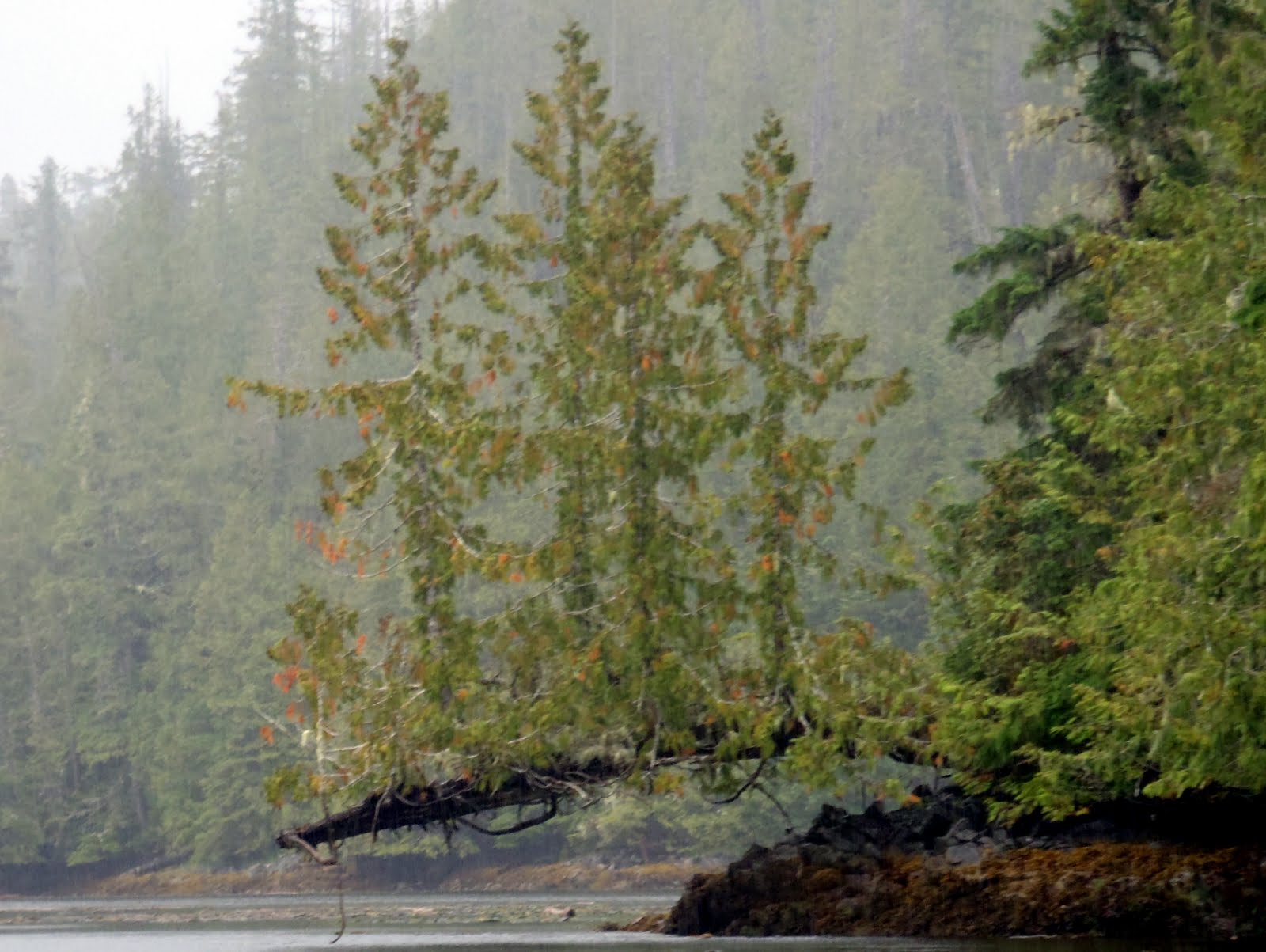
West Beach, Calvert Island
This is our third time on this beach, and this time we turned left instead of right and walked a couple miles all the way to second beach. It is a beautiful coast line, with unbelievable beaches, definitely worth the walk. 
This was either third or forth beach.
These were on the side of the trail, but not sure what type they are. I can't help it, I love taking pictures of mushrooms too!
Now, back at the boat, we pulled up the crab trap again, and yes, you guess it, nothing!! Oh well, we still love coming to this spot and will come here again, crab or no crab!

Kildidt Narrows and Inlet

Monday August 22, 2011
leave Spitfire
arrive Kildidt Lagoon, Gnat Group then move to Bremner Bay 51 50.80N 128 06.78W
Looking glass water just at the eastern end of Spitfire Channel, going into Kildidt Sound.

Halfway inside Kildidt Inlet.
After pulling up anchor in Spitfire Cove, we carefully navigated our way through Spitfire Channel, the beginning of which is only 20 feet wide and a least depth of 6 feet at a zero tide. To add to the difficulties, there is a tree overhanging the entry by about 10 feet. So, we chose high tide to go through, but even with the extra room, it was probably the tightest narrows we have been through. Coming out the other side into Kildidt Sound, the water was so smooth, we felt like intruders into another world. 
Without hesitation, we decided to carry on through Kildidt Narrows and explore Kildidt Inlet. We did not see any other boats nor any evidence of people, as in logging, float homes, roads or garbage. If you want a feeling of isolation, this is the place to be. It was just us and the seals. 
Brown water from the cedar trees.
We anchored near the Gnat group of islands, got in the dingy and headed back to the narrows for a look at low tide. The water in the inlet is stained brown from all the run off from the cedar trees, but as we got closer to the narrows, it cleared up and we could see the bottom.....
If we wanted sea cucumber for dinner, we would have had no problem getting enough to feed a crowd.
As you have read before, I love taking pictures of the underwater life, and here it was beautiful of course. We also spotted a colony of sea pens growing on a sandy spot in about 15 feet of water, but I had trouble getting a good picture because the current was pushing us around too much.
Back at the boat, we decided to pull anchor and head back out through the narrows and find a more sheltered spot for the night which is why we ended up in Bremner Bay. The boat we were anchored with in Spitfire was already there, so I guess we both had the same idea. We slept nicely.

Monday, December 26, 2011

Spitfire Anchorage... some history from WWII

Sunday August 21, 2011
leave Superstition Cove
arrive Spitfire West Cove, Hurricane Island 51 51.51N, 128 12.27 W


After the rocking and rolling from the previous night, we decided to snuggle into a nice calm cove. We picked Spitfire Cove on Hurricane Island because it said it was snug in the guide book (Cruising the Secret Coast). Another boat had the same idea, but we managed to fit in okay. True to it's word, the book was right and we enjoyed a very calm night.
The islands in this area are named after air force planes from WWII. There is a ruin of a radar station from the 1940's on Spider Island. We didn't stop since we were not having the best of weather, but it definitely deserves a look on another trip, maybe we will be back there this coming up summer.

Back at it after the Christmas break....

Saturday August 20, 2011
exit Kinsman Cove
arrive Superstition Cove, Hunter Island 51 53.52N, 128 14.46W

This area is starfish heaven, in every colour you can imagine.
I know it has been awhile since my last post, but seriously, I have been busy doing the Christmas thang. But now that we are more or less back to normal around here, I feel like I really should finish off our trip this summer, at least before we take off again on another journey!
Nice thing about blogging about our trip now, is that I get to almost relive all the fun times we had.... such good memories.
So, our next stop was Superstition Cove as we made our way south along Hunter Island. The cove is somewhat exposed to the west but we thought we would give it a try. We had it to ourselves and it seemed to be a nice enough anchorage, but as luck would have it, the wind picked up a bit and we ended up having a rocky night. A little bit of rocking is okay, but this was too much and neither of us got a good nights sleep. We didn't do any exploring here as the weather was not that great. In nicer weather, this would be a place to stay a couple nights.