Wednesday, July 22, 2009

Dodger Passage to Port San Juan


Sunset in Port San Juan

Monday July 20, 2009
Leave: Leave Dodger Passage 0530
Arrive: Mill Bay, Port San Juan
The morning started off very badly as we hit the bottom of the keel on a rock and then the rudder also hit a rock. We have done something to the rudder, but the extent of the damage will have to wait until we get home and have a look. I am sure we are going to be hauling out in the near future to do some repair.
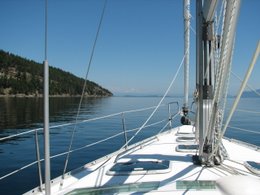
But the rest of the day, went not too badly. It was choppy but not windy to start, but as we moved away from Barkley Sound, the chop died off, and the swells evened out.

Sunday, July 19, 2009

Refuge Island to Dodger Passage


Black bear near our anchorage at Refuge Island.

Saturday & Sunday, July 18-19, 2009
Leave: Refuge Island 0945
We stayed two nights at Refuge Island because it was such a perfect anchorage. It was quiet, protected, scenic and great kayaking. Friday night we took the dingy up a small inlet to the end and discovered a beautiful river emptying into the inlet with waterfalls and pools. So, Saturday morning we took our towels and soap and headed up in our kayaks for a swim and a bath! It was wonderful!

Today we have had some discussion about whether or not to head out of Barkley Sound today or stay one more night. The winds are favorable for a trip today, but it is getting late to get started. Tomorrow the forecast is for light winds, not the best scenario. We are still undecided... tune in later for more details!
The verdict is in, we are staying one more night.
Arrive: Dodger Passage, 1600
We had a great afternoon sail across Imperial Eagle Channel, with winds up to 22 knots. We are settled in for the night now, the wind has mostly clamed down. We will get a very early start in the morning...... probably about 5:30 to head down Juan de Fuca to Port Renfrew or further if things are going our way.

Friday, July 17, 2009

Pinkerton Islands to Refuge Island


Improvised hummingbird feeder...
The hummers were so aggressive in this anchorage (flying right into our cockpit, trying to find something to eat around my head, etc), we finally decided to give them something to eat. The beer can has sugar water in it, I poked a hole in the side for them to feed from. I had to catch three of the little buggers to get them out of our cockpit, they kept flying in to find something to eat and then couldn't figure out how to get back out!

Friday July 17, 2009
Leave: Pinkerton Islands, 1430
The Frances Barkley taking a load of tourists to Ukee. Can you see the sailboat just coming out of the fog?

Arrive: Refuge Island, 1615
Lat: 49 01.63 Lon: 125 18.80
The scenery here is absolutely gorgeous ! On one side we can see the high mountains of Vancouver Island and on the other side looking west we can see little islands in the bay and the setting sun behind. We had 15 knots of wind today, but right now it is very calm. We are going touring in dingy after dinner and maybe try a little fishing. We saw fish jumping in the bay before we put down the anchor.

Thursday, July 16, 2009

Robinson Island to Pinkerton Islands


The fog starting to lift while we ate our breakfast.

Thursday July 16, 2009
Leave: 0715
There was no internet reception at our anchorage, so we have hit the water early to hook up again to see what is happening in the world! Same old stuff, really!
The fog is very thick, and we are using radar and our gps to guide us. We stopped to have breakfast close to Canoe Island, then continued on and found a nice anchorage in the Pinkerton Islands.
Arrive: 1215 Pinkerton Islands, north side of Broken Group
Lat: 48 57.55 Lon: 125 16.75
This is a very quiet little anchorage, with beautiful green water. It is super clear, we can see down maybe 20 feet! Kayaked around the Pinkerton Islands, it is pretty here but not as much to see as yesterday. We are looking forward to the sunset tonight, hopefully if the fog does not come back.
I played around with the colour on this picture on the trees, but the water is the same.

Wednesday, July 15, 2009

Bamfield to Alma Russell Islands


Cave on Robinson Island.

Leave: Bamfield 0830
Woke up today and the fog has rolled in again but the forecast is for clearing and some wind this afternoon. Rick and Rosita jammed out on our sailing trip today because of the weather, but will take us up on our offer to sail in the Gulf Islands.
We are headed east in Barkley Sound to explore the eastern side which is actually part of Vancouver Island.
Arrive: 1145 Robinson Island, Alma Russell Islands
Lat: 48 57.10 Lon: 125 12.31
Trip log: 155.9 nm
This area is hugging the Vancouver Island Coastline, along the eastern shore of Barkley Sound, close to the entrance to Effingham Inlet. We have tucked in behind Robinson Island, out of the wind if any comes up. The ocean swell has been reduced to pretty much nothing here.
A kayak tour around Robinson Island was a fun adventure, turning up some caves (it was low tide and a little too rough to enter) and TONS of starfish of all kinds. They are so beautiful while underwater, and very difficult to photograph with my camera. It is looking more and more like I am going to need a new camera that is waterproof.

Just before dinner, we headed out in the kayaks again to take a tour of Julia Passage. This is an area that is float home central. Most of the homes are summer only, but a few have year round residents. Very interesting lifestyle. Check out the vegetable garden on the left side of the house.

Tuesday, July 14, 2009

Tzartus Island to Bamfield

Tuesday July 14, 2009
Leave: North Tzartus Cove 1115
We are slowly making our way through Imperial Eagle Channel and then on to Bamfield. Tonight we are having dinner with Rick and Rosita at their house.
Arrive: Bamfield Inlet 1345
Lat: 48 49.51 Lon: 125 08.38
Toured around Bamfielf Inlet in the dingy before heading to Rick's house "Seaview" to have a wonderful fresh (as in a few minutes ago) crab dinner and barbequed salmon. Yummm!

Sunday, July 12, 2009

Tzartus Island


Star fish coat the rocks at low tide.

Sunday July 11, 2009
Leave: Robbers Passage 1430
We are going to explore around the south east corner of Barkley Sound and then anchor on the west of Tzartus Island
Arrive: North Tzartus Cove 1745
Lat: 48 55.16 Lon: 125 06.17
Trip log: 165.00 nm

Saturday, July 11, 2009

Barkley Sound... time to explore!


Getting ready to head out for a kayak around Diana Island in the fog.

Saturday July 11, 2009
We got to sleep in this morning to 7:00! It was very quiet and when we looked outside we couldn't see anything! We were in pea soup fog, but it is starting to life now, the sun is warming the boat up, Jerry is washing the breakfast dishes, and we will be heading out for a kayak shortly as low tide is at 9:45 this morning.

Friday, July 10, 2009

Becher Bay to Barkley Sound, Dodger Channel


Our anchor collected some 'stuff' overnight! This was the biggest glob of seaweed we have ever collected in one short night.

Friday July 10, 2009
Leave: Campbell Cove 0520
We got an early start because we were rudely awoken by all the recreational fishermen zooming by in their boats! Oh well, it was just as well, because then we will just make it a super long day and get all the way to Barkley. It is almost lunch time right now and we are past Port Renfrew and almost even with Cape Flattery on the Olympic Penninsula.
No wind yet and we have the current going with us.
Arrive: Dodge Channel, between Diana Island and King Edward Island 1845
Lat: 48 50.05 Lon: 125 11.69
Trip log: 145.5 nm
Today was a battle from after lunch until we put the anchor down. The winds picked up to 25 knots almost straight on, and the waves were 2 meters. We motor-sailed all afternoon, and are now exhausted and ready for bed! Jerry is already asleep.
Tomorrow we get to sleep in, enjoy some down time and then get the kayaks out!

Thursday, July 9, 2009

Portland island to Campbell Cove in Becher Bay


Sun coming up this morning over the sailboats anchored near Sidney Spit.

Thursday July 9, 2009
Leave: Princess Cove, Portland Island 0645
So far, no wind, but forecast is for 15 -20 knots this afternoon, coming straight at us. We are getting an early start to try and avoid the winds.
Arrive: Campbell Cove 1320
Trip log: 68.0
Lat: 48 19.65 Lon: 123 37.83
Beautiful open bay, protected from the 15-20 knot westerly winds whipping through Juan de Fuca Straight. The water here is so clear, we could see our anchor chain laying on the bottom 16' down. The sun is out and it has turned into a beautiful day.
Tomorrow we plan another early start to beat the wind again and have the currents going in the the same direction we to give us a boost.

A little reminder of home!

Wednesday, July 8, 2009

We're off again... to Barkley Sound... Woof Woof


The 7:00 pm ferry leaving Sidney Harbour.

Wednesday July 8, 2009
Leave: Our dock 1245
Trip log: 0.0nm
Our first stop will be fuel and water in Chemainus.
Fuel: 82 lt $76.57 Hours: 1479
Water: both tanks full.
Through Sansum Narrows, around the south end of Saltspring Island to Portland Island.
The winds were either right on our nose or non existant all day, so we have had to run the motor. Once we get the anchor down it will be nice to listen to the peace and quiet.
Arrive: Portland Island, Princess Bay 2000
Trip log: 30.4 nm
Portland Island was given to Princess Margaret (1958) as a gift, but then in 1967 she gave it back to the province to make into a marine park. Another island that is very close by, Brackman Island is a nature reserve created by The NCC.

Tuesday, May 26, 2009

North Cove to Ladysmith Harbour, again!


As we pulled our anchor up in North Cove, we found a beautiful sun star clinging on for dear life along with a piece of seaweed. This picture was taken just as the starfish came loose from our anchor chain.
Monday May 25, 2009
Leave North Cove, Thetis Island 0930
Arrive at our dock, Ladysmith Harbour 1200
We meandered home, taking in a tour around Evening Cove before heading back to our dock. Our next trip is already in the works. We will be heading over to Barkley Sound for three weeks at the beginning of July. Until then... happy cruising, wherever you are!

Leaving Howe Sound, back across Georgia Strait


Sunday May 24, 2009
Leave Halkett Bay, Gambier Island 1015
Arrive: Manion Bay (also known as Deep Bay), Bowen Island 1145
49 23.11N 123 19.87 W
We stopped for a look around Snug Cove on Bowen Island, lots of people around having fun at the park, playing baseball, kayaking, or just sipping on coffee. It was a very busy place. 
Leave Manion Bay 1530
Arrive North Cove, Thetis Island 2130
49 00.91N 123 41.63W
Our cruise across Georgia Strait started off with the promise of a nice sail, but it soon to calm winds and we ended up motoring the whole way. We rode the current through Gabriola Passage, stopped in Tricomali Channel for dinner and then started up again heading for our anchorage in North Cove.


Saturday, May 23, 2009

Gambier Island wildlife

Here are some pictures we took while touring around Halkett Bay in the dingy.

The Black Oystercatcher


and the Common Merganser


Gibsons and then off to Gambier Island


Saturday May 23, 2009
Time:1145 Leave Gibsons
We spent the morning having a look around Gibsons, stopped for coffee and 11'sies.
We are heading to Gambier Island, circumnavigating and then anchoring in a calm bay, yet to be decided, tonight. The winds are very lite today, remains to be seen if we get the sails up.


Splendid Mane at anchor near Gibsons, looking north towards the mainland.

Time: 1630 Arrive Halkett Bay, Gambier Island
Trip: 20.4 nm
We did manage to get the sails up for a bit of the day, but mostly just motor-sailed around Gambier. After arriving at Halkett Bay, we went for a walk through Halkett Bay Marine Park.

Friday, May 22, 2009

Howe Sound


Sailing across to Howe Sound

Friday May 22, 2009
Time: 0730 Leave Silva Bay, Gabriola Island
Beautiful weather for saiing, 15-20 knots. We got the sails up right away and headed across to the mainland, towards Howe Sound
Time: 1130 Arrive Plumber Cove Keats Island
Tied up to the public dock and went for a hike in Plumber Cove Marine Park.


Time: 1400 Leave Plumber Cove Arrive Gibsons 1430
Trip: 25.1 nm
Anchor close to public warf, we are realxin after a hard days work.

Back on the water, finally!


Thursday May 21, 2009
Time: 1345 Leave our home dock
Hours on engine: 1443 (Oil change done)
1745 Arrive Silva Bay, Gabriola Island 49 09.00 123 41.79
Trip:16 nm
It seems like it has been a long time since we did any boating. Although we did take one short trip earlier this year, we have been madly working on our house renovation, and not doing too much boating. But the weather is beautiful making the decision to get our on the water an easy one. This will be a short trip to explore Howe Sound, which we have not done before.


Tuesday, December 2, 2008

North Cove to Ladysmith Harbour


Tuesday December 2, 2008
Lv: North Cove 0800
We are heading to Chemainus to fill with diesel, then heading north to Ladysmith
Fuel: 89 L, $88.10, hours on engine 1434
Arrive: our dock, Ladysmith Harbour 1230
Trip Log: 1384
It is always good to be home again, but we enjoy our boat so much that we are already planning the next trip.... looks like Victoria for Christmas.....

Monday, December 1, 2008

Sidney to North Cove, Thetis Island


Monday December 1, 2008
Lv: Sidney Marina 1100 Overcast, foggy, not raining, yet.
Arrive: North Cove, Thetis Island 1810
Lat: 49 00.97 Lon: 123 41.45

This was our third choice for an anchorage for the night, but it is one of our very most favorite places to put the hook down. It is always quiet here, and whether the sun is coming up or going down, you'll always have something nice to look at. We arrived in the dark, actually the last couple hours of our cruising was in the dark, but happily found North Cove deserted.

Stuart Island back to Port Sidney


Sunday November 30, 2008
Lv: Stuart Island 1100 Very thick pea soup fog.
Arrive: Port Sidney Marina 1315 Check in with Canada Customs (clearance # 2008-335-0110)
Log 1336
We almost turned back right at the outset because we couldn't see anything. But then decided this would be good practice using our radar in combination with our GPS. Since there is no wind, we are motoring all the way, I was out on deck listening for fog horns from passing freighters and tugs. Our visability was about 1/4 mile most of the way, but closer to Sidney the fog started to lift. Of course, I did not waste my time standing around doing nothing. The deck was very nice and clean by the time we arrived in Sidney! 

Westsound to Stuart Island

Saturday November 29, 2008
Lv: Westsound, Lopez Island 1030 Raining lightly
Arrive: Between Stuart Island and Satellite Island Log: 1325
Lat: 48 40.90 Lon: 123 11.74
Another day of nothing too much exciting. The humidity is so high inside the boat, we are having trouble keeping things dry. The new system we set up for our bed is working perfectly, but the hull gets pretty wet inside the lockers. On our trip to Alaska and also around Vancouver Island, we found that our mattress was getting very damp because of the cold coming up from the water tank underneath and the heat coming off our bodies. So, we built a platform out of cedar decking, effectively raising the mattress about 2 inches off the base of the bed, allowing air to circulate and it really works to keep things dry. But, now we have to figure out what to do inside lockers and inside the cabin in general. These are the things boat people worry about! Economy? What economy!
Below, the Olympic Peninsula at sunset. 

Shoal Bay to Westsound, Orcas Island

Friday November 28, 2008
Lv: Shoal Bay 1020
Raining and 6 degrees, winter weather.... uggghhh.
Arrive: Westsound, Orcas Island 1200
Lat: 48 36.59 Lon: 122 58.76
We are starting to enjoy this! Jerry is reading the book I bought him for his birthday.
We are hoping that the weather clears enough tomorrow that we can do some hiking on Orcas Island. Our aim is to hike up to the top of Turtleback Mountain, a very new park on Orcas. This 1,578 acre preserve came up for sale in the late 1990's and a group of islands banded together, raised the money and purchased it, saving it from developement. It was only just opened up to the public this past spring. But if the weather does not clear, we will have to wait until the next time, the reward at the end of the hike is the beautiful view.

Another day to relax, but that is what this is all about anyway. 

Barlow Bay to Shoal Bay, Lopez Island


HAPPY BIRTHDAY JERRY, YOU'RE LOOKING PRETTY GOOD!

Thursday November 27, 2008
Lv: Barlow Bay 1030
Arrive: Shoal Bay, Lopez 1615 Log: 1303
Lat: 48 33.31 Lon: 122 52.50
Hours on engine: 1414
Nothing too exciting today, the weather seems to have decided to change for good to winter. It is gloomy and slightly drizzely, and we are motoring all the time now. Besides, it's a day to relax, read some good books and reflect on life.

Friday Harbor to Lopez Island


Wednesday November 26, 2008
Lv: Friday Harbor, San Juan Island 1230
Arrive: Barlow Bay, Lopez Island 1615
Lat: 48 26.34 Lon: 122 52.31

The day started off rather gloomy, but by the time we were ready to leave Friday Harbor, the sun was shinning and we could see that the wind was picking up. On our way to Lopez, we passed Whale Rock where a large colony of sealions reside. Living space is at a premium, and the large males were able to take the choicest spots, while youngsters had to scroung around for avaliable space at the tide line. They were making lots of barking and grunting noises as we passed, keeping a wary eye on us.


Haven't seen the killer whales yet.......

Wednesday, November 26, 2008

Roche Harbor to Friday Harbor, San Juan Island

Tuesday November 25, 2008
Lv: Roche Harbor 0945
It is raining today, our first day of rain, but no surprise, that is what the forecast said.
Arrive: Friday Harbor 1230 Log 1264
Lat: 48 32.36 Lon: 123 00.95


It didn't quite rain the whole day, and we could see the sun shinning off to the west over Vancouver Island so we knew that it would be coming our way soon. The wind kicked up to 15 knots and we got some nice sailing in. We didn't see the killer whales, but they are around. Our first stop in Friday Harbor, after checking in at the marina, is the Whale Museum.  They reported that the L Pod was spotted off the west side of San Juan that morning, but we were on the east side. I am confident we will see them on this trip.

Killer whale skeleton at the Whale Museum in Friday Harbor.

Sidney to Roche Harbor, San Juan Island

Monday November 24, 2008
Lv: Sidney 1330
Arrive: Roche Harbor 1530 Clear customs, anchor in harbor
Lat: 48 36.72
Lon: 123 09.47


We had a beautiful sail across Boundry Pass today, accompanied partly by a small school of dolphins. It is so fun to watch them as they swim along beside our boat, zooming back and forth, under and behind, like they are having so much fun. I think when they see you watching them, they act up even more. They seemed to appear from nowhere and then vanished just the same.
We cleared customs easily and then decided to anchor out in the harbour, enjoying a very quiet night. 

Sunday, November 23, 2008

On to Port Sidney

Sunday November 23, 2008
Lv: Parker Island 0845
Log: 1223
We are having so much fun, it seems like something should happen to spoil it..... the weather forecast is for rain later today but the sky is telling us it will be a nice day. We have the sails up, and are moving along through Swanson Channel at over 7 knots... that seems like pretty slow to you power boaters, but for us it is ROCKING!!! Oh, up ahead!! Jerry yells there is a Killer Whale!! I almost throw my back out whipping around to get a look only to see that it is only a log drifting by. Erggg!! Well, I am confident we will see the pod of killer whales that lives near by, but I am saddened by the fact that scientists have lost track of 7 of the pods members and think they may have died of starvation this past summer and fall. The last time we were near Boundary Pass, we saw the pod, but they were about a mile away. Hopefully, we will be lucky on this trip and see them again.


Arrive: Port Sidney Marina 1320
Lat: 48 39.24 N
Lon: 123 23.60 W
We decided to splurge and take a birth at the marina tonight. Sidney is such a nice little town... Jerry will be able to do some work tomorrow morning on the computer while I spend some time looking around the many little shops in Sidney. But we may have spoiled ourselves....... we are of course hooked up to power and right now we have the heater going, the music blarring (Beatles, thanks to Steve), ALL the lights on, and of course the computer. What more could you want? It is beautiful here right now... there are no other boaters, no lookie loos, the only thing we have to watch out for it the sea gull and dog shit on the docks..... yeah, you guessed right...... I stepped in the doggie one. I just don't understand why people let their dogs take a crap on the dock and then just leave it there. Do you think I should lighten up a bit? NOT!


Tying up in Port Sidney Marina.

Taking advantage of some nice weather........

Saturday November 22, 2008
Lv: Ladysmith Harbour 1330
Hours on engine: 1392
Log: 1203
We had originally planned to leave yesterday but the weather was so nasty (wind and rain), that we decided to wait a day... besides, what's the hurry? We have all the time we need. Not that we are sissies, but hey, it is all about comfort and fun, right? Anyway, glad we waited because the day was an absolutely perfect as far as the weather (winter) is concerned. We enjoyed a nice 15 knot breeze as we were heading down Tricomali Channel towards our anchorage near Montague Harbour. The only other boats we came across, out to disturb our solitude, were 5 hot rod power boats that looked like they were racing around Salt Spring Island. Obviously, they have too much money to BURN!

Arrive: Parker Island 1630
Lat: 48 53.65 N
Lon: 123 25.14 W
We put the anchor down in a small cove near Parker Island. We are alone except for one or two harbour seals and some cormorants. Ahhh, this is the life. We just love getting away and out on the water. Words really do not do justice to how nice this is. Now our only challange is to keep the boat warm enough so we don't have to use our survival suits!


Wednesday, October 8, 2008

Fill up in Maple Bay:
110 lt $1.48 1379 hrs.