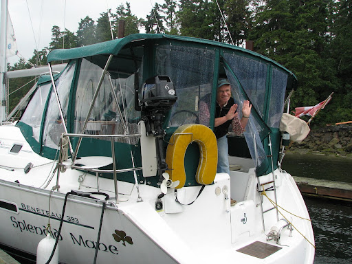
Thursday, June 19, 2008

Friday June 20
Depart: Chapman Islet, Koskimo Bay 1330
Cloudy, raining lightly 12 C
Arrive: Gooding Cove 1700, Lat: 50 23.99 Lon: 127 57.19
Trip Log: 367.9 nm Day: 10 nm
We hung around all morning because we had a great connection on the internet. On our way out of the inlet, we tried fishing (no luck yet!) and then decided, despite the weather forecast of 25 - 30 knots of wind, that we would attempt to get out of Quatsino and head a little further south towards Brooks. As we stuck our noses out, we decided it was not worth the rough weather to get only a few miles, so we tucked into an out of the way bay for the night with a couple kayakers.
The winds are howling out on the coast, so this is a good time to enjoy our quiet little anchorage, do some looking around, even in the rain and nasty weather.

Koskimo Bay anchorage


Thursday June 19
This is another day of sitting and relaxing while the winds howl out on the coast. We are still at anchor in Koskimo Bay and it has been raining all day so far. I went out earlier this morning for a low tide exploration while Jerry got some time to himself on the computer. I have enough mussels for dinner tonight, they are the big California mussel, so I would think that 4 or 5 each will be plenty. I'll let you know how dinner turns out.
Hopefully the weather clears a bit and we can move on tomorrow. Our plan is to get to an anchorage just north of Brooks Peninsula in Klaskino Inlet. We may spend a day or so there, and then sail around to the south side of Brooks and do some kayaking around the Bunsby Islands.

Wednesday, June 18, 2008

Quatsino Light House Station

Ron and Rene, Quatsino Light House Keepers.

Ron calling in the 9:30 weather report.
The view from their house.
Wednesday June 18
Depart: Winter Harbour 0745
Overcast 12 C, winds light
We are going to have breakfast and then go for a tour of the Quatsino Light House. Ron and Rene along with their 4 kids, border collie Tess, and assistant gave us a tour around the grounds. It is also home to a miniature horse and about 10 chickens, eagles, a deer or two and in the past they have had a cougar and a bear . It was very interesting to be able to see how the light house keepers live. They have been working as light house keepers since 1994 and it is easy to see they love their lives. In their past life, they were teachers in Prince George. They have a beautiful garden where they grow lots of fruit and vegetables, and best of all they are surrounded by the sea!
Ron had mentioned to Jerry that they had a web site so after a little searching I found it... here is the link.... http://www.fogwhistle.ca/thisandthat/index.html. It is a very good picture of what life would be like working as a light house keeper. Many thanks to Rene and Ron for sharing with us.
Arrive: close by Chapman Islet, Koskimo Bay Quatsino Inlet 1520
Lat: 50 27.57 Lon: 127 52.16
Trip Log: 355.8 nm
We put the prawn trap down in about 120 feet, not really feeling to optimistic, but the chicken skin was really starting to stink. :-)
We didn't travel far today, partly because we had the internet off a local tower and also, the weather is suppose to turn nasty tomorrow.

Heading south to Quatsino


Tuesday June 17
Depart: Sea Otter Cove, 0830
Raining, light winds, 11 C The weather pattern has definitely changed, we are seeing more rain and winds from the southeast.
We had a slight mishap on the way out of Sea Otter Cove at low tide, and of course I was in charge of the helm at the time. Hmmm, well we just barely touched bottom, and then had to quickly through it in reverse to get off the sand bar. Nothing serious, but another lesson to learn.
Arrive: Winter Harbour 1520 Lat: 50 30.91 Lon: 128 01.74
Trip log: 339.0nm day: 29.8 nm
We took our dingy to shore, and met the people who run the light house. They invited us to come visit them before we leave the area. The picture above is the old fish canning house at Winter Harbour. The sun did eventually come out, and we enjoyed happy hour outside in the warm sunshine.

Rope on a dock.

Lowrie Bay Beach


Monday June 16
Today is a day of relaxation! We want to explore around this area and decided to go for a short hike to Lowrie Bay Beach. The 40 minute walk was through a bog, pretty much the whole way, so it was quite messy. But once we got to the beach, it was worth it. Very beautiful! We enjoyed just walking in the sand and surf, and beach combing, another favorite pastime.
By the way.... the picture of Jerry reading the article titled "Life Begins at 50" seems to have mis-interpreted. Have another look at the picture, and if you click on it to make it bigger, you will see that 50 has nothing to do with age! :-)

Around the Cape!


Sunday June 15
Depart: Clam Cove 0600
Still overcast, maybe some sun breaking through, 11 C
Arrive: Sea Otter Cove, Vancouver Island 1500 Lat: 50 40.68 Lon: 128 21.07
Trip log: 309.1 nm day: 40 nm
Well we did it, and had some good sailing too! We listened to the weather forecast this morning and it sounded like a good day to make the turn around the north end of the island. It is something you have to plan carefully for because of the tides, currents, and winds. In the picture above, although no a very good picture, you can see what they call the "dancing waters". This is right at the tip where the currents from Queen Charlotte Sound meet the currents coming off the Pacific, causing the water to "dance". It was really quite interesting. After turning southwest, we had a nice sail until almost Sea Otter Cove (and yes we saw some sea otters).

Clam Cove, Nigei Island


Saturday June 14
Depart: Patrician Bay, Vancouver Island 0900
Overcast, light rain, 13 C
Arrive: Clam Cove, Nigei Island 1330 Lat: 50 52.29 Lon: 127 40.31
Trip Log: 260.5 nm
Clam Cove is a very protected anchorage with a couple floating homes (now home to a scuba diving business) and a LOT of humming birds. The owner has 4 feeders and has to fill each one twice a day. We went out kayaking, and then stopped to talk to him, and the birds never stopped feeding while he stood inches away from a feeder.
The picture above is of the entrance to Clam Cove as the sun is setting (reflected across to the mountains on the mainland).

Friday, June 13, 2008

Super(stition) day, our best sail yet!!


Friday June 13th
Depart: Port McNeil
Raining, 13 C, yukky
Arrive: Patrician Bay, Vancouver Island (just south of Port Hardy) 1615
Lat: 50 43.47 Lon: 127 24.98
Trip log: 244.0 nm
We are confident that we are getting all the rain over and done with so that when we round Cape Scott, the sun will be shinning, a nice wind will be blowing at our backs, and we won't have to even think about using our rain coats! :-)
After motoring for about 10 miles, we were finally able to put up both sails to get some beautiful sailing with 15 knot winds. Queen Charlotte Strait was a little bumpy, but with the sun shinning and the wind blowing, we had a great time.


At anchor in Patrician Bay.

It is raining in Port McNeil... surprise, surprise!


Thursday June 12
Depart: Spout Islet Cove 0715
Overcast with light rain 13 C, calm
Arrive: Port McNeil 1030 Fuel up again 70L @ 1.42 $104.30 Hours on engine: 1195
Trip log: 222.5 nm

We are meeting Mavis and Walter here (they are in their camper/truck unit) for a get together/dinner on our boat, one final send off before we head around the island. It pretty much rained ALL day, but we did manage to get a few groceries, clothes washed and had a nice dinner of roast turkey and all the fix'ns.

Thursday, June 12, 2008

Johnstone Straight and Robson Bight


Wednesday June 11
Depart: Douglas Bay, Forward Harbour 0545
Overcast 13 C, calm in bay, 10 - 15 knots in straight.
Arrive: Spout Islet Cove Hanson Island 1500
Lat: 50 35.16 Lon: 126 45.04
Trip Log: 208.7 nm
As with the previous day, our times are all screwy. Leaving an anchorage at 5:45 am is really not normal for us, but again the forecast if for strong winds through Johnstone Straight. Upon entering JS, we met by the JS greeting committee.... a school of dolphins escorted us for a kilometer or so. They are so fun to watch, you can almost imagine how much fun they are having as they zoom around and under our boat.
We passed Robson Bight (picture above) where the resident Orcas come to scratch their bellies on the stones. Boats are not allowed anywhere near, but we did not see any whales today. :-(
Our anchorage for the night was rough from the wakes of passing boats, so we had a hard time getting comfortable, but finally fell asleep.

Johnstone Straight weather makes it a short day.


Tuesday June 10
Depart: Bickley Bay, 0820
Windy day today... we have 15 -20 knots with some high cloud and sun and about 14 C
Arrive: Douglas Bay, Forward Harbour (Mainland) 1230
Trip Log: 162.8 nm
The weather forecast was for winds up to 40 knots in Johnstone Straight in the afternoon, so we decided to get an early start to miss the worst of it. We wouldn't normally call it a day at 1230, but it definitely wasn't worth fighting the wind to make it a few more miles. Six other boats arrived at our anchorage shortly after, which tells me we made the right decision.
We went for a walk through the forest and came across a big blow down from a few years ago, but it did give us an idea of the type of storms that go through here. Some of the trees were massive!

Inch'n our way up the island


Monday June 9
Depart: Otter Island secret anchorage 0640
Stop: Refuge Cove for fuel 50L @ $1.58!!! (that is $6.32 for a US gallon for all my family stateside, so quit your belly achin) Hours on engine: 1173
Arrive: Bickley Bay 1700
Lat: 50 26.69 Lon: 125 23.63
It has been raining ALL day but we are very dry and comfortable on our little boat.
Trip log: 142.6 nm


We pulled up the prawn trap this morning and there was absolutely nothing in it, not even a piece of seaweed or jelly fish! Oh well, I think we need to put it down deeper. We are hoping that we get all our rainy weather out of the way before we get over to the west coast. It really hasn't been that bad, we are on the Wet Coast after all.

Sunday, June 8, 2008

Otter Island


We have put our anchor down in a little cove close to Otter Island. Here is a picture of Jerry stern tying our boat! This is not really that complicated, and he makes it look so easy! After this it is a good thing he is not missing in action!
Stern tying for the purpose of anchoring requires a person, usually the man, to get in the dingy (after already setting the anchor at the front of the boat) with a line that is attached to the stern of the boat, row to shore, and loop the line around something sturdy, in this case an arbutus tree that already had a short line attached to it. Then you have to get back in the dingy, row back to your boat and tie the other end of the line to your stern as well. The idea is so that when you are in a tight anchorage, your boat will not swing around, causing havoc in the middle of the night. While all this is going on, the other person, usually the woman, is having to control the boat, feed out shore line, and take abuse from the other person who is having any number of problems. Easy!

Desolation Sound


Sunday June 8
Depart: Copeland Islands Marine Park 0810
Light rain, 13 C , some clearing to the north
Arrive: Otter Island anchorage, 1130
Trip log: 103.7 nm
We are heading to Desolation Sound today. Our prawn trapping was not successful last night in 180', but we will try again today maybe a bit deeper.
We have noticed A LOT fewer boats on the water this year.... may be because of the price of diesel, but it sure is nice having the anchorages nearly deserted.
The picture above is looking north towards Refuge Cove, over to the left would be Cortes Island (not in the picture) and to the right is West Redonda Island.
We are going out kayaking and at low tide today we will try to 'catch' some oysters, shoudn't be too difficult. :-)

Saturday, June 7, 2008

Ripping past Powell River


It is tough work sailing this boat!

Bath time in Johnstone Straight


Saturday June 7
Dep: Bargain Bay 0730
Sunny with a few clouds, 15 C, light winds
Arrive: Copeland Islands Marine Park 1830
Trip log: 96.2 nm

With the wind in front of us and the sun shinning, we took an opportunity to have a shower on the transom. Ahhh, this is the life!
We are heading up Johnstone Straight hoping to be somewhere in Desolation Sound this evening. We will probably not have internet service, so you may not see an update for a day or so. We are going to put the prawn trap down tonight, keeping our fingers crossed for a nice haul!

Friday, June 6, 2008

Heading to Pender Harbour


Friday June 6th
Dep: Silva Bay 0730
Overcast sky, weather calls for windy in Straight of Georgia
Trip Log: 46.5
Arrive: Bargain Bay 1400
Lat: 49 36.90
Lon: 124 02.19

This is our first time anchoring in Bargain Bay. It is beautiful and very quiet... we are the only boat anchored in the bay although there are lots of homes with docks and boats tied up along the shore. After dinner we headed out for a dingy ride, through a small channel and into Pender Harbour. There are lots of homes for sale along the water, most in the 2 million and up range! Yikks!

We're off!


Thursday June 5, 2008
Dep: Ladysmith Harbour 1515
Hours on engine: 1145 (oil change)
Trip log: 0.0 nm
Raining, 12 C, light winds
Arrive: Silva Bay 1915
Trip: 14.7 nm

We had a uneventful first day on the water. We got to Gabriola Passage a little too soon for the slack tide, so decided to put our anchor down for an hour in Wake Bay, on the north end of Valdes Island. We stayed the night in Silva Bay, it was a bit bumpy and crowded but we were so tired we didn't care.
Off to Pender Harbour!